- It is important not just to consider the advantages and disadvantages of the hardware but also the area that is covered by the different satellite services.
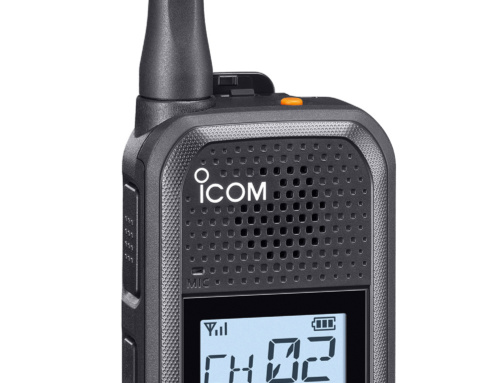
- EPIRBs are good, part of the GMDSS and should be your first port of call if you are in distress.
As long as you are close to the shore there are several apps for your mobile phone that will track your position and plot it on a map, telling your friends and family where you are. If you run into trouble you can always use your radio or mobile phone for help. But what if your trip involves going offshore away from cellular and radio reception? Gilbert Park looks at the various alternatives for staying in touch and summoning help offshore.
My background is in anaesthesia and intensive care, where being prepared for a foreseeable problem is expected. So when I started planning for a trip from my home port of Aigues-Mortes (near Montpellier) in the South of France to Menorca (Puerto de Fornells), I became aware that there is a large area en route where normal VHF (let alone mobile phone) communication with the coastguard is not possible. A sea area with VHF DSC reception is known as Sea Area A1, while in Sea Area A2, medium-frequency radios or satellite communication can be used.
Some readers may not be worried about a lack of contact for a few hours. My experience of being in such a predicament includes being towed by a lifeboat just last year when my engine failed, while two years before I temporarily ‘lost my mind’ while at sea. And this year I was on a ferry with four engines and a few generators that lost all propulsion and electrical power in the middle of the English Channel for two hours! All these incidents made me think I ought to stay in touch in case I need help.
The most important safety net is the Global Maritime Distress and Safety System (GMDSS), and so the first thing I did was to look at my EPIRB. EPIRBs are good, part of the GMDSS and should be your first port of call if you are in distress. However, there may be a delay in you being aware that a rescue is happening. They are also passive devices that don’t tell you when the message you’ve sent has been received. What if the problem does not put you in ‘grave and imminent danger’? Should I still use the EPIRB? I thought not and so started to investigate other ways of communicating a problem.
What are the options?
I first decided to look at medium-/high-frequency radio and went on a course at YachtCom to investigate the options further. This was a very instructive course that covered the whole of GMDSS, not just MF/HF radio, in four days. At the end of it I did get a wonderful licence from the Secretary of State no less!
The worst-case scenario would be finding myself injured or ill and in need of help. MF/HF radio, like normal VHF radio, has a red button to push and hold for distress. This would make contact easy for the crew ‒ in my case my wife ‒ if I was incapacitated. The problem would be with the subsequent communication, dealing with the channels etc. This might prove difficult, especially if she was busy dealing with my injuries or illness. It would also be expensive to install (about £5,000), but then free to use as much as I wanted.
The next one I considered was a satellite phone ‒ but bear in mind this problem may only arise twice a year and last for perhaps four hours. The outward and the return trip will also be separated by perhaps six to eight weeks. Perhaps I could buy one or even hire one … The problem is the high cost of calls.
Then it struck me that youngsters today don’t telephone each other for a chat but text instead. Perhaps that’s the way for me to go, using a satellite text messenger … They can also be used to upload your position at regular intervals to a map available for friends and relatives to see, hence the name – satellite tracker.
Text messaging would actually prove a benefit here because my wife could deal with the messages in a calm moment. In addition, you can’t take an MF/HF radio into a life raft.
Satellite coverage
It is important not just to consider the advantages and disadvantages of the hardware but also the area that is covered by the different satellite services.
Inmarsat has three satellites orbiting 22,000 miles above the equator (geostationary). This means that the further you are away from the equator, the more difficult it is to connect. Indeed, the polar regions have no connection at all.
By contrast, Iridium and Globalstar have lots of satellites constantly zooming around the earth. Iridium has truly global coverage, but Globalstar, like Inmarsat, does not. You should study the coverage maps on each provider’s website to see whether or not the area you are visiting is covered.
Getting help
EPIRBs and PLBs (personal locator beacons) are strictly regulated, with registration needed for each device. Satellite trackers are regulated only by the satellite company. Most trackers have an SOS button, similar to that found on a VHF radio. Press and hold it for several seconds and the message will be sent. Some trackers allow you to cancel the SOS if the situation resolves itself.
The other notable feature is that all of these devices with an SOS facility link through to the GEOS emergency centre. Since GEOS will be contacting the same rescue centre that receives your EPIRB alert, this offers a two-source alert in case one is not working.
GEOS
The GEOS International Emergency Response Coordination Centre (IERCC) has handled emergency distress signals in over 160 countries, including thousands of alerts from boats of all sizes. The IERCC coordinates rescues with the same agencies that would receive and respond to your EPIRB activation, and if there are no official agencies, they can summon private help. For all the trackers that have GEOS you have to have an active satellite subscription, as without that you have no SOS function. Activating GEOS should always be done in combination with an EPIRB/PLB as these devices are the ones used throughout the world to bring rescuers to you.
Insurance
Search and rescue (SAR) is covered by the International Convention on Maritime Search and Rescue. A feature of the convention is that signatories will ensure that assistance is provided to any person in distress at sea and will do so regardless of the nationality or status of such a person or the circumstances in which that person is found.
Generally, SAR is provided free of charge by signatories of the SAR Convention to persons in distress, although some countries may charge if they deem the callout is not a distress situation. It is possible to insure for expenses related to search and rescue (rather than the rescue itself). You can also insure for personal medical expenses for yourself, for damage sustained to a boat in a rescue and for travel expenses if a rescue does not deliver you to an intended destination.
Reading the information about GEOS, I came across an insurance scheme that offered reimbursement of SAR fees. However, this was only available if GEOS also received an alert from a GEOS-supported device, such as the ones in this article. So if you trigger your EPIRB as well as the GEOS system and the coastguard sends rescue based on the EPIRB, GEOS SAR or cruisers membership will help to offset any cost associated with the rescue. The GEOS cruisers membership also includes medical evacuation coverage should you need it virtually anywhere in the world.
I thought I didn’t need any additional insurance, so I checked. To my surprise, the boat was fully covered but my personal cover was somewhat lacking, despite being provided by a large company specialising in marine personal accident cover. I have now changed insurers so that my boat and personal insurance for both my wife and myself are with the same insurer, who between the two policies covers all the eventualities.
Hire vs buy
There are arguments both ways for both phones and trackers. Hiring works out cheaper for the occasional trip and you always get the latest equipment. But there is the hassle of receiving and returning the package ‒ I am sure readers will have experienced the frustration of waiting in all day for a package that didn’t arrive. Then the question of familiarity arises. In an emergency, you don’t want to have to find out how to switch the device on, connect to a satellite etc. All the trackers are small and can be used on land, so you may want to use your device all year round, including, say, when skiing or travelling abroad, as part of your safety planning. Finally, at sea, owning one means you have the backup of a second system to call for help even when near the coast.
Renting is an option for both phone and tracking devices. To get an idea of price, I asked a supplier what the cost would be for my one-way journey, with the device coming out to me in France and going back to them from Menorca. All prices include VAT and have assumed that the sailing is done in one day, allowing for time to return the phone within seven days ‒ the usual minimum rental period. The phone package has been valued at £500 and the tracker at £300 ‒ sent by courier with a three-day service. No customs duty has been assumed (this may change after Brexit). The cost of the courier is an estimate. Interestingly, the price was about the same at around £90 (excluding any calls, texts etc., which would be charged separately). As I am planning to come back by a different route that would remain in Sea Area A1, I only need a device for the seven-day minimum.
Trackers
Mostly these trackers have been designed to be used by backpackers and motorcyclists going into an isolated area. This is the reason they usually come with a karabiner for attaching to your rucksack. For most (but not all) trackers, their use in boats seems to be a secondary consideration.
If you do use one, remember it is not a cellphone and it takes time to send and receive text messages. Having a conversation by text doesn’t work well.
There are three types of satellite texting devices. The first is very simple and just sends a signal saying you are in distress or need help and giving your GPS location to GEOS. The second allows you to send a distress call ‒ and send and receive text messages as well. The third satellite tracker is again one that uses a mobile phone as a remote keyboard to send and receive text messages, but it doesn’t have a link with GEOS. It does have an alert button, however, and this can be programmed so that one of your contacts can act as an emergency contact. In the event of a problem, they would then be able to call the coastguard and maintain contact with you.
All of the trackers are waterproof and allow connection to a computer to update and set up contacts and predefined messaging etc. They should all be kept away from other GPS devices (such as a chartplotter) to avoid interference. They all have compass and waypoint facilities. All of them also have some form of online mapping available so relatives and friends can see the track. Some even link straight to your social media page. There are usually several different usage plans and the basic ones are given below. Choosing the right plan is important as usage outside of the plans can be very expensive. Note that all prices given below are exclusive of VAT.
The selection below represents the ones I have seen ‒ you may find others. Like most electronic items, it pays to search around to get the best deals.
SPOT Gen3
This is a small (871 x 65 x 254 mm), light (114g with batteries) tracker working on the Globalstar network. It allows tracking points to be sent every 2.5 to 60 minutes (additional cost for 2.5 minutes, 10 minutes is standard) and can be programmed to stop sending when there is no movement. There is a check-in function that will send a preprogrammed text or email message to up to 10 of your contacts to say you are OK. It also gives them your location and a link to Google Maps that will show this position.
There is also the SOS button to GEOS and an SOV (save our vehicle) button that can be used to alert your contacts that you are not in grave and imminent danger but you are broken down.
You can also send predefined text messages that will give your location and let you say what service you need for the SOV function.
Four AAA batteries power it, and these will last for at least 1,000 messages or about 10 days. Its USB port can also power it.
- Cost: £97.50
- Annual plan: €179.99
- Annual maintenance fee: €19.99 (not for first year)
- Monthly cost: €17.99 first year; €19.98 thereafter
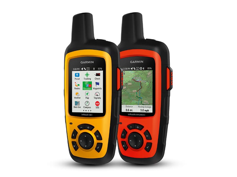
Garmin InReach Mini
This is the smallest device on the market, measuring 99 x 517 x 261 mm and weighing in at a meagre 100g. It has a small monochrome screen measuring just 23 x 23 cm and a rechargeable battery giving 50h of use with a 10-minute tracking interval. It uses the Iridium network that has global coverage.
Despite its small size, it packs a lot of features. Besides the SOS button, by using the Bluetooth connectivity to a smartphone you can send and receive text messages and emails, track and share your location, and request weather forecasts. If you have a Garmin watch it will even connect to that.
It is one of the two trackers that offers a marine kit (holder and charging lead).
- Cost: £233.33
Satellite connection: See below
Garmin satellite plans
Garmin offer annual as well as monthly plans for both the InReach Mini and Explorer. However, you need to be very careful choosing your plan. The basic safety plan (shown below) includes 10 text messages, unlimited preset messages and unlimited SOS messages. However, everything else (tracking points, location pings etc.) is charged for. Extra text messages cost 42p.
- Annual safety plan: £149.9 plus £16.66 activation fee
- Monthly safety plan: £12.50 plus £20.83 activation fee
Garmin InReach Explorer
This is very similar to a handheld GPS, with a coloured screen and a directional pad. Land-based maps are available for the SE model and all the usual navigation functions are available to use with them (waypoints, compass etc). With its Bluetooth connectivity, it can link to a smartphone to make sending and receiving texts and emails easier than using the directional pad to scroll up and down each letter. Like the Mini, it communicates with a Garmin watch and enables you to download the Earthmate app onto your phone to see exactly where you are on land.
It measures 68 x 164 x 38 mm and weighs 213g. The battery is rechargeable and will last 100h at 10-minute tracking intervals. The screen size is 3.5 x 5 cm . Being Iridium based, it will work all over the world.
- Cost: £329.17
- Cost SE model: £370
Satellite connection: See above
SPOT X
This tracker is unique in that it is the only one that has a backlit keyboard and 8cm screen. It looks like a slightly large Blackberry phone. The keyboard is a bit small and fiddly to use, but it is still familiar to all users. The unit itself measures 166 x 74 x 44 mm and weighs 198g. You can send ordinary-style text messages and the basic package includes 20 per month, and after that each message costs 25c. You also get unlimited check-in messages, predefined messages (up to 14 can be stored) and tracking (at 10-, 30- or 60-minute intervals). Messages to other SPOT users are free of charge.
The screen is monochrome and at times the writing is a little small. However, the screen can be inverted to white writing on a black background, which makes it easier to read. Selection of items is done with a directional pad and is straightforward.
It has rechargeable batteries through its USB port that last for up to days in 10-minute tracking mode and works through the Globalstar satellites.
- Cost: £257.50
- Annual plan: €143.40
- Annual maintenance fee: €19.99
- Monthly cost: €14.95 annual fee; €24.99 thereafter
Yellow Brick
The YB3 is the only unit that is mostly aimed at the sailor. It is rugged, measures 144 x 76 x 36 mm (plus antennae) and weighs in at 303g. The battery is rechargeable and has a life of three weeks with tracking set to every 15 minutes. It has a monochrome 26 x 35 mm [SB6] backlit screen with a directional pad. The pad can be used to scroll around the menu and to input text messages, emails etc. It also has Bluetooth compatibility with smartphones, making sending text messages and emails much easier.
It does not connect to GEOS in an emergency; instead it has an alert button that you preprogramme. It also has some other types of alert not found on other devices. There is the ‘Dead man’s switch’ alert where you set the timer for a suitable time and you have to press a button before reaching that, and it then restarts the clock. If you don’t press a button an alert sounds to remind you, and if you still don’t press a button an alert message is sent. There are other alerts for temperature, travelling out of a defined zone and even a collision alert.
The YB works through the Iridium satellites and has a unique way of charging. You pay a monthly fee (£8.33) for line rental and buy credits. The cost of credits goes down from 10p if you buy 50 to 7p if you buy 1,000.
Credits are used each time you transmit. One credit is used per tracking position or for 50 characters of a message sent or received, plus one credit for an SMS delivery. If you check your mailbox and there are no messages waiting, this costs one credit. Credits only expire if you do not use your account for 12 months.
- Cost: £322.50
I am grateful to YachtCom for their course and help with MF/HF radios, the RYA for commenting on the article, Global Telesat Communications for their advice and information on some of the satellite trackers and phones, and finally to YB Tracking Ltd for details about the Yellow Brick.
Related Posts

