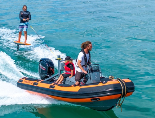
HMS climbs aboard a 3.5m RIB and sets off on a mini voyage to explore the unique sights and wonders of Dorset’s ancient and ever-changing coastline.
Watch our walkaround video of the Ribcraft Leisure 350 and exclusive review.
There are few areas of our British coastline so archaeologically diverse in nature, rich in history or strikingly beautiful as the coastline fringing the fair county of Dorset. Essentially, it begins in the east with Poole Harbour, one of the largest natural harbours in the world, before then stretching westward, overlooked by the gentle, rolling Purbeck Hills with their alluring hues of green and mauve. The glorious sands of Studland Bay act as a precursor to the iconic white-chalk Old Harry Rocks, which in turn give way to the seaside pleasantries of Swanage Bay, before the coast takes a more aggressive tone with the arrival of Durlston Head and the churning waters beneath Anvil Point.
South of Swanage, the Dorset Coast Path leads its energetic, thin green line of walkers – who can often provide an audience for passing vessels running close to shore – right along the top of the cliffs between Anvil Point and St Aldhelm’s (St Alban’s) Head. The honeycomb-type rock strata between these two famous promontories are a sight to behold, and in my experience of having circumnavigated the British Isles several times now, the 5 miles of cliff line seen here is truly unlike anything you’ll encounter anywhere else.

Durdle Door © Paul Crosby

Getting the little Ribcraft ready for launch.
The pool and the tower
If you have never visited Chapman’s Pool, I would certainly recommend it. Like so many features associated with the Dorset coast, the character of the ‘pool’ or cove, once again, is wholly different to any other you’ll come across within the sum total of the West Country’s 630-mile-long coastline. With a tower of grey shale on its western flank and banks of colourful flora and scrub climbing its eastern face, this deep-water, peaceful haven has been a favoured haunt of fishermen and other souls of the sea for centuries. Indeed, a certain timelessness exists within the lee of Chapman’s Pool.

Lulworth Cove. © Joe McCarthy
Heading west some 3.5 miles, and upon the sight of the Clavell Tower greeting the eye, Kimmeridge Bay is made. Its low-lying slopes of neatly cropped pastureland give way in undramatic style to a shore of shingle and limestone rock, the latter extending its spines far out into the bay to form reefs and all manner of deadly shallows. To be caught out here aboard a stricken vessel in a strong southerly would undoubtedly be the stuff of nightmares. Take care, then, when sightseeing in the waters of Kimmeridge Bay, for as beautiful as they may be, the mermaids who swim its ledges and shallows have the power to lure an honest ribster to their doom!

The stunning Lulworth Cove. © iStock-Fela Sanu.
Ancient discoveries
Past Kimmeridge, the cliffs rise once more, but this time in imposing, regal splendour. Yet again, within just a couple of miles, the vista changes, bearing no relation to that which has gone before, nor that which is to come. Only Dorset has the ability to morph its coastal appearance so eloquently, so dramatically.
Worbarrow Bay, overlooked by the Lulworth gunnery range, marks the point where, when heading west, the Purbecks make their final farewell. From here on in, we begin to encounter the great green sweeps of the county’s ancient chalk Downs, home to the increasingly rare brown and black Lulworth skipper butterfly, and which at one time, before the Iron Age deforestations, also offered sanctuary to all manner of wildlife, including wild boar, rock lion, wolves and even brown bear. Many archaeological sites in recent years have continued to throw new light on the extent of the influence the Romans had in the region. But perhaps even more fascinating are the discoveries relating to Iron Age settlements and the peoples who once inhabited these coastlands 3,500 years ago. All manner of artefacts, and even the unearthing of ancient human remains, are changing the way academics perceive the past. Indeed, it would seem that Dorset has much to answer for and no doubt much more to reveal!

Durdle Door’s famous arch.
Through the ocean waves
By now, you may be thinking it’s about time we introduced a boat into the story. And you’d be right, because it has to be said that while the likes of the South West Coast Path remain among Britain’s great natural wonders, the finest coastal experience, surely, has to be the one enjoyed from the vantage point of the ocean itself. In recent years, paddle-powered craft have given many people access to the water at relatively minimal cost. But where finances allow, a small RIB offers even greater opportunities to explore, go further afield and discover many more sights along the way. This is because a RIB’s inherent qualities afford it the ability to not only ‘cover ground’ but also to search out the coast’s fascinating detail at ultimately close quarters. I recently took a Ribcraft 3.5m RIB from Portland Harbour out across Weymouth Bay toward Burning Cliff and White Nothe Undercliff, located on the opposite shore just east of Ringstead Bay. It was the perfect little boat for a day’s adventure, and as good fortune would have it, the sun was shining high in the sky, the sea was settled and the colours of the Dorset coast were absolutely matchless in their beauty.

Paddleboarders enjoying the calm waters and fine weather.
Kingfisher blue
Along the few miles of the Dorset coast between Ringstead and Bat’s Head, the brilliant white-chalk cliffs rise sheer and proud in a form that is absolutely vast. The closer one edges beneath their gaze, the more impressive and imposing they become. The shallow draught of the RIB allowed me to idle right in here, beyond where the surf line would normally exist. But on this day, the conditions were so settled, the sea so clear and undisturbed, that all I needed was a couple of feet beneath my hull. The surface of the water shimmered and sparkled and held an iridescent quality beyond that of simply blue or turquoise. In fact, I would muse it was more akin to the wing feathers of a kingfisher. The sound of the waves lapping and receding on the narrow stretch of shore, coupled to the cry of the gulls above my head, completed the experience. As for the Suzuki outboard’s gentle ticking astern, this was so polite and unobtrusive that it did nothing to disturb the peace or rob the moment of its serenity.
I was heading for Lulworth Cove but didn’t want to miss a single facet or detail along the way. However, I was reminded of the fact, particularly off Bat’s Head, that care needs to be taken here when choosing a course very close inshore. There are a good number of isolated rocks, some of which lie semi-awash at low tide, so venturing in toward the cliffs in anything less than perfectly settled conditions would be unwise. But on this day, while keeping a keen lookout, it was possible to ‘chance one’s hand’ to some degree. This opportunity meant the sea floor was plainly visible off the side of the boat down through the cold, crystal waters, where between the brutal rocks and ledges, sugar kelp, sea lettuce and bright green ulva intestinalis (grass kelp) could be seen swaying silently on the ebbing tide.

A very busy Lulworth. © Joe McCarthy
Underneath the arches
Durdle Door is a sight to behold on any day and in any weather and ranks high among Britain’s long list of natural wonders. Its arch of Portland stone is the final remnant of a once-solid archaeological feature, the softer stone of which has long since been eroded by the prevailing elements. Interestingly, the wave-carved ‘mousehole’ at Bat’s Head may yet prove to be the humble start of another mighty sea arch, but in the case of Durdle Door, the process of decay has reached its glorious climax and, for the next century or so at least, will no doubt continue to afford the shelving, half-moon beach its unique and dramatic outlook.
If you don’t fancy taking your boat through the arch, you can still appreciate it at intimate quarters, but beware of swimmers and paddleboarders, as well as the rocks that lie in the cove a little way to the west of your position.

Exploring Stair Hole
© Joe McCarthy
The natural wonders fringing the ocean abound here. For instance, just a gentle ‘pootle’ eastward you’ll discover the delights of ‘Stair Hole’ and its associated caves. The ‘Durdle Door effect’ is everywhere you look, and with my little 3.5m Ribcraft I was able to explore the cramped confines of Stair Hole to the full. In fact, any boat over 5 metres in length would simply be too large to traverse the full length of the cave, let alone emerge in the sunlight of the hidden miniature cove set behind it.
A king among coves
The location’s high cliffs of crumbling chalk form a natural amphitheatre around the oyster-shaped cove known as Lulworth Cove. This beautiful little haven, formed long ago by the sea attacking joints and fault lines within the Portland stone, resulted in the creation of arches that finally broke right through to undermine and excavate the softer clays behind the rock until a cove was formed. This extraordinary mix of soil and rock types accounts for so much of the Dorset coast’s character and the nature of its ever-changing appearance.

Heading up to Durdle Door © Joe McCarthy
As you enter Lulworth Cove from the sea, you immediately appreciate its outstanding harbour-like qualities and the degree to which it represents such a wonderful anchorage for yachtsmen and motorboat owners alike. Facilities ashore are scanty admittedly, but then again, self-sufficiency represents much of this location’s charm. There is, however, a small landing pontoon at the foot of the path that leads to the hamlet, but in truth, unless you’re visiting by RIB, you’ll likely require a tender, and in any case, you’ll need to anchor off. Ashore, there’s a splendid Hall and Woodhouse brewery pub, which not only serves great Badger ales but also very good grub. A fresh-fish shack and a Dorset ice cream shop can be found on the village lane during the summer months too. Visiting Lulworth is always an enjoyable and welcome experience, and even if you’re not planning to stay overnight, it certainly makes for a very worthwhile ‘port of call’ en route, whether you’re heading east or west on passage.

Suzuki 40hp proved the ideal partner to the Ribcraft 350.
Less is more
Without doubt, the miles covered aboard the Ribcraft 350 that day were a sheer delight. Powered along by her moderate-sized but highly capable 40hp Suzuki outboard, when I desired a turn of speed I had some 30 knots at my disposal, which was great, because it meant I could really push along offshore at speed. But then, upon closing the coast, when I wanted nothing other than solace and serenity, the 4-stroke motor was as quiet as a whisper. In other words, this was a great combination to take two people out on a day’s exploration of this coast in all its fascinating close-up detail – and all for less than a 25-litre tank’s worth of fuel! For me, though, my endearing memory will be those towering, dazzling white-chalk cliffs east of Ringstead Bay – truly unforgettable, as is every mile of this nautical adventurer’s rich and rewarding playground.

Suzuki 40hp
Monstrous find
In December 2023, the skull of a sea monster was excavated from a Dorset cliffside. The monster, which is referred to as the ‘T. Rex of the seas’, is known as a ‘pliosaur’. The Dorset pliosaur fossil is the best-preserved of any pliosaur remains in history and was the primary subject of a David Attenborough BBC special that was screened on 1st January 2024. However, the excavation process was a dangerous feat. Palaeontologists and climbers had to work precariously in order to painstakingly remove the creature’s monstrous bones that were hanging from the cliff face.
Of course, the pliosaur was not the only major sea monster roaming the ocean in prehistoric times. For fans of Jurassic Park, who may be more familiar with the mosasaur, although the pliosaur and the mosasaur looked relatively similar, there are some key differences between the two. The mosasaur had a slimmer reptilian build, measuring an estimated 56 feet in length, whereas the pliosaur was more heavy-set and shorter in length at around 40 feet. Nevertheless, in terms of brute strength, the pliosaur may have had the upper hand over the monstrous mosasaur. When hunting, the mosasaur is thought to have swallowed the prey whole, whereas the pliosaur would use its large mouth and teeth to tear even larger animals to pieces.
The skull recently uncovered was 6 feet long and contained 130 teeth, which would have been as sharp as daggers. The skull also revealed the possible size of the pliosaur’s mouth muscles, which helped researchers conclude that their jaws likely had the force of 33,000 newtons. According to the BBC, this is double that of a saltwater crocodile – at 16,000 newtons, today’s most powerful jaw. (Source material courtesy of greenmatters.com.)
Lulworth Ranges
The Lulworth Ranges are military firing ranges located between Wareham and Lulworth. They cover an area of more than 2,830 hectares (7,000 acres). The ranges lie about 6 miles west of Swanage and around 9 miles east of Dorchester within an Area of Outstanding Natural Beauty that stretches along the coastline between the east of Lulworth Cove and just west of Kimmeridge. The range includes the ghost village of Tyneham, deserted in 1943 and abandoned permanently following its compulsory purchase by the army in 1948.
Firing programme
Details of the firing programme, including any changes to the forecast listed above, are sent monthly in advance to all the main yacht clubs in the area. Lulworth Firing Programme can also be viewed on the gov.uk website. Broadcasts regarding firing times are emitted on Radio Solent (300m, 221m, 96.1MHz and 103.8 MHz) during the shipping and weather news at about 0645 and 0745 hours on weekdays.
Boatfolk marina services
The marina at Portland is run by the marina operator boatfolk. It’s one of the best-appointed facilities in the south-west of England, with hundreds of marina berths, excellent visitor services both on water and ashore, a substantial slipway, good parking, a café, washrooms and, very importantly, dockside petrol and diesel. In addition, there’s also land-based fuel provided at the marina’s hoist dock. E5 petrol and red diesel are served at both locations between the hours of 0800 and 1700 (last fuel request at 1630). During peak times such as the Easter and summer school holidays and bank holidays, this extends to 1900, Thursday to Sunday. If you need fuel outside of these hours, the marina staff will do their best to accommodate you, and contact can be made via 01305 866190 or VHF Channel 80 (call sign Portland Marina) to request assistance.
In the case of boatfolk’s neighbouring Weymouth Marina just across the bay, this is also a great facility accessed by the town’s old harbour with its historic frontage of shops, bars and eating places. But the secluded marina itself offers over 250 berths, high-quality washrooms, a card-operated laundry, car parking, electricity to all berths and Wi-Fi. In terms of fuel, you’ll need to head over to Portland Harbour/Portland Marina, a run of about 15 minutes or so going west, back across Weymouth Bay.
Danger signals
Red flags are flown and red flashing lights are displayed from the flag staffs on Bindon Hill and St Albans Head only when army firing is taking place. However, further ashore, mariners may notice some red flags that fly whether or not firing is taking place; these mark the range boundary. Range safety boats operate at the outer extremities of the weapon danger area. Lulworth Range Control monitors VHF Channel 8. Range safety boats listen on VHF Channels 8 and 16 when firing is in progress.
Relevant enquiries can be made through NAVY FOST Ops on 01752 557550 or the Solent Coastguard on VHF Channel 16.

Going the distance in the little Ribcraft.The conditions were near perfect.
Ribcraft 350 profile
- LOA: 3.5m
- BOA: 1.7m
- Internal length: 2m
- Hull weight: 200kg
- Tube diameter: 380mm
- Chambers: 3
- Max. people: 4 (seating for 2)
- Fuel capacity: 25L detachable tank
- Motor: 40hp Suzuki OBM


