Introduction to Tides and Navigation
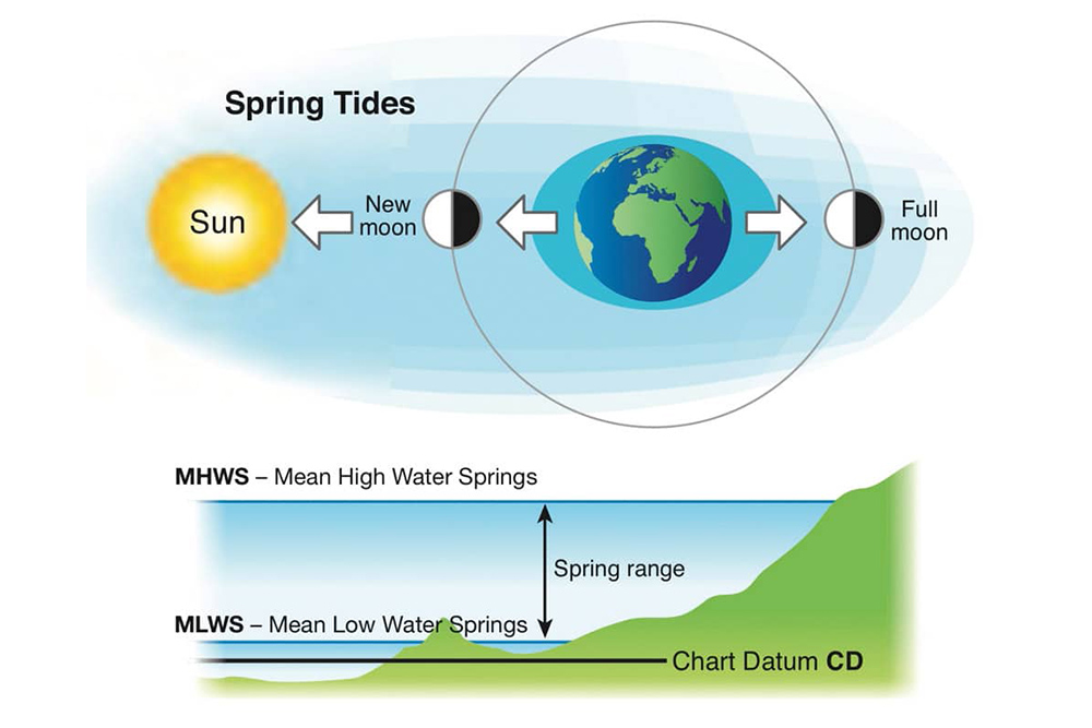
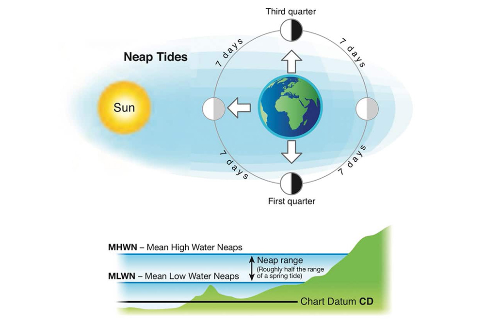
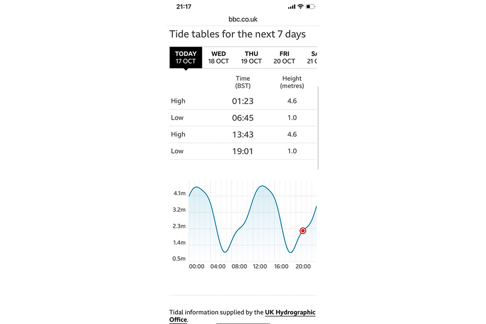
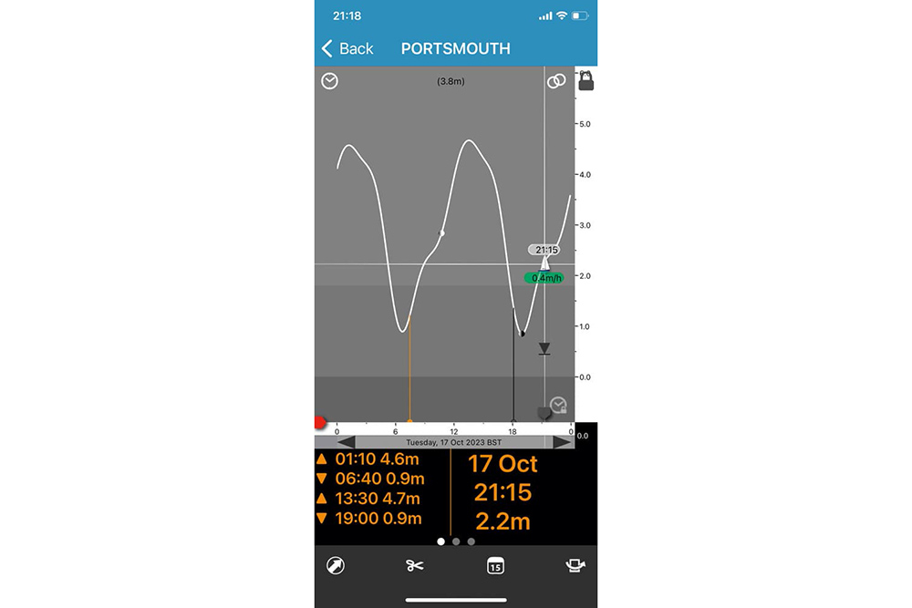
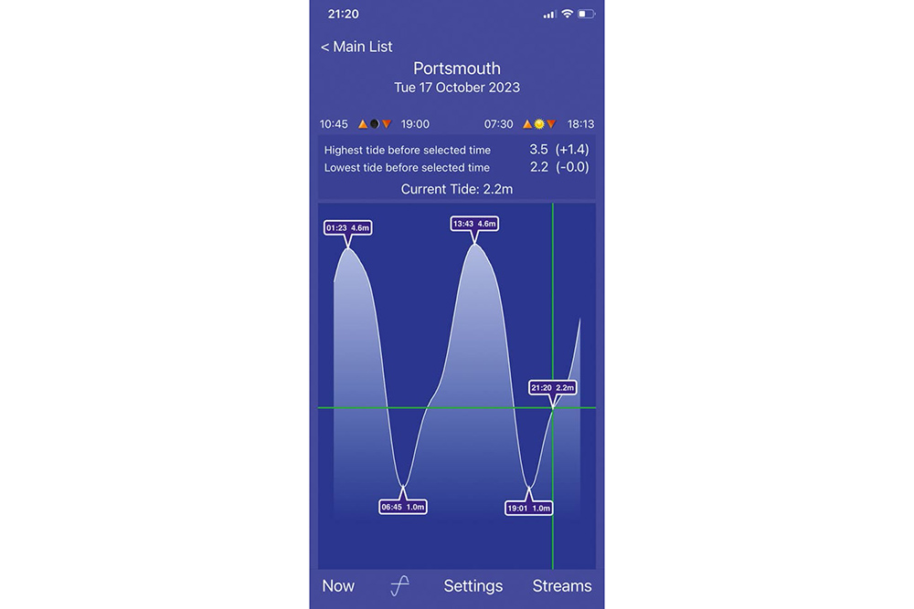
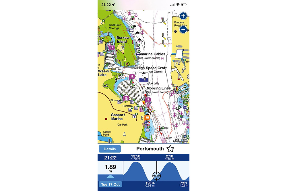
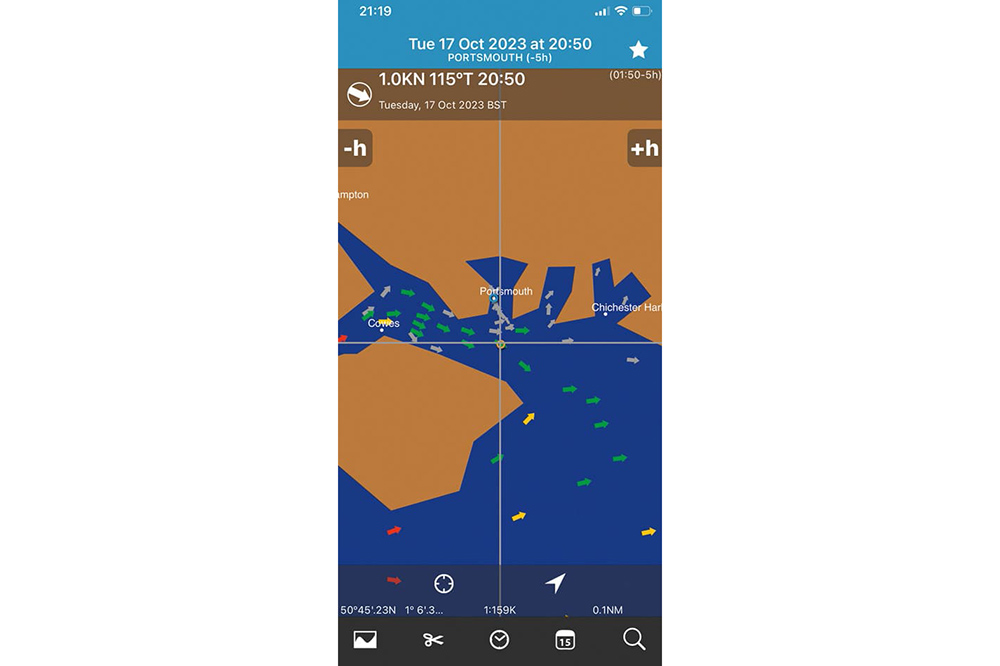
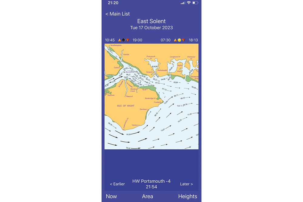
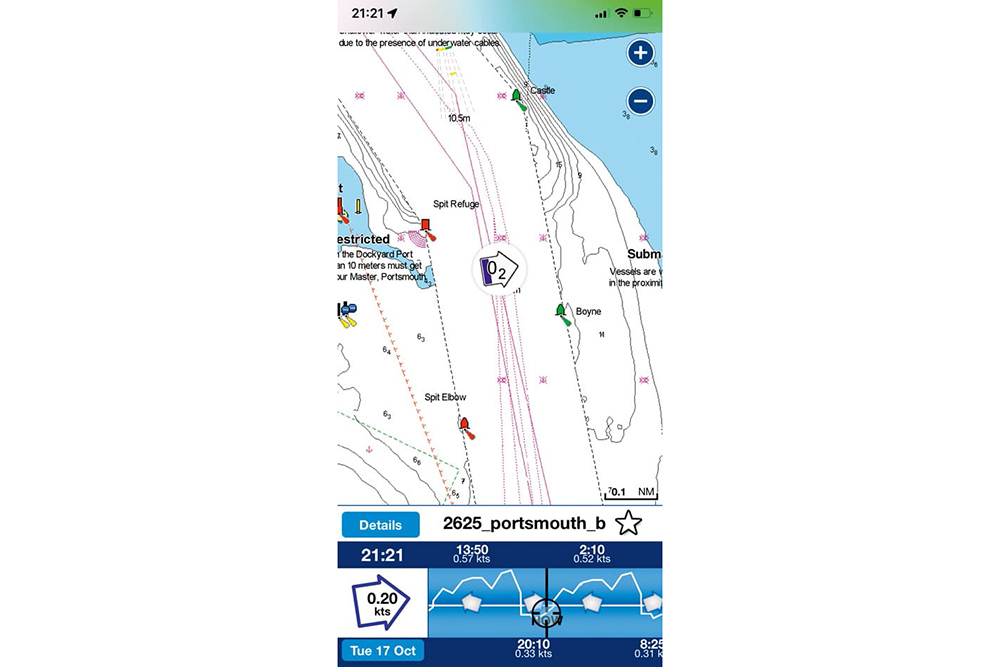
Back to Basics Part 3: Tides In the third part of this ‘Back to Basics’ series, Paul Glatzel discusses tides and where we can obtain the essential information needed … Welcome to the third in this ‘Back to Basics’ series of articles. Previously we’ve looked at charts/chartplotters and the information we can find in these to help us have the most enjoyable and safest time afloat. Charts of all types are only of any use, though, if we also have access to tidal information and can interpret our charts to determine how these tides will affect us.