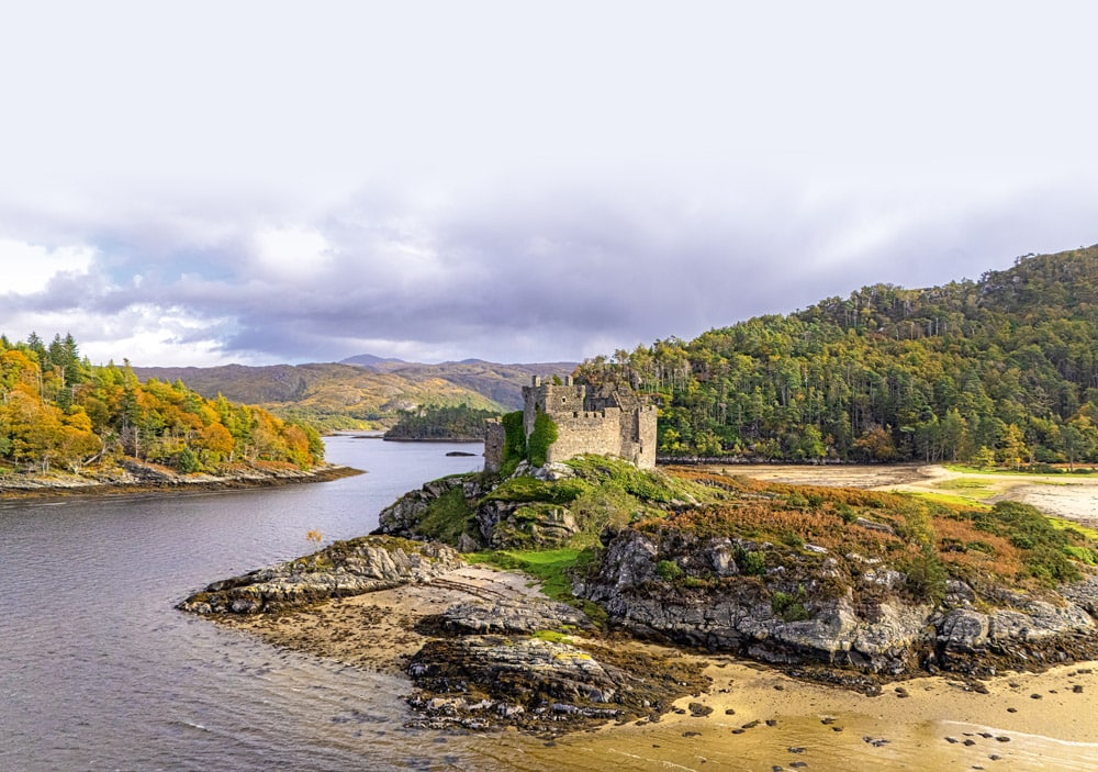
River of Dreams – Helford River
Rainforests, ancient fiefdoms and tales of pirates mingle with hidden coves, cobb cottages and wooded riverbanks...
Advertisement

My first visit to Loch Sunart was by chance, years ago. Strong winds meant that a week’s sea kayaking with National Outdoor Centre Plas Y Brenin, planned for the Small Isles, had to be rethought at the last minute. A more sheltered route down the Sound of Mull and up Loch Linnhe was hastily planned. The unscheduled drive to our new start location in Loch Teacuis took us through spectacular scenery in an area where I’d not been before. Passing a campsite on the side of Loch Sunart with a slipway, I’d logged it as a potential future boating option.
A few years later, my friend Graeme and I took the Zodiac I owned at the time to Loch Sunart and camped at a site with a slipway (Resipole). Using it as a base, we explored the length of Loch Sunart and got over to Tobermory on the Isle of Mull. Surrounded by fantastic Highland scenery, we enjoyed seeing seals, porpoise and seabirds, and by car we visited the Ardnamurchan Lighthouse and the Arisaig Highland Games.
Over the next 10 years, my boat trips with friends and family became more coastal and further afield. In Norway, I enjoyed separate trips along the extensive Hardanger and Storfjord networks, which shared similarities with my Loch Sunart trip but had a few extra challenges. Resipole held good memories, and a return started to feel overdue. Mam hadn’t seen this part of the west coast, so a plan emerged for a trip together, with a mix of boating and land-based sightseeing. We booked a lodge for longer than I’d camped with Graeme, aiming to see more of the region and its wildlife.
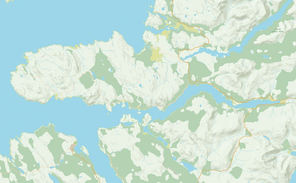
The cruising ground
The road journey to Resipole involved a planned detour near the end, as with the Corran Ferry out at the time, we rerouted via Fort William. Driving the last few miles south from Lochailort gave us excellent views out to Rum, Eigg and Skye in fantastic weather. We experienced a few rainy days after our arrival, however, so we opted to use these to tick off some planned land-based sightseeing and walking. With the boat set up next to the lodge, fuel tanks full and equipment at the ready, we were well placed to get afloat when conditions improved.
Resipole slipway
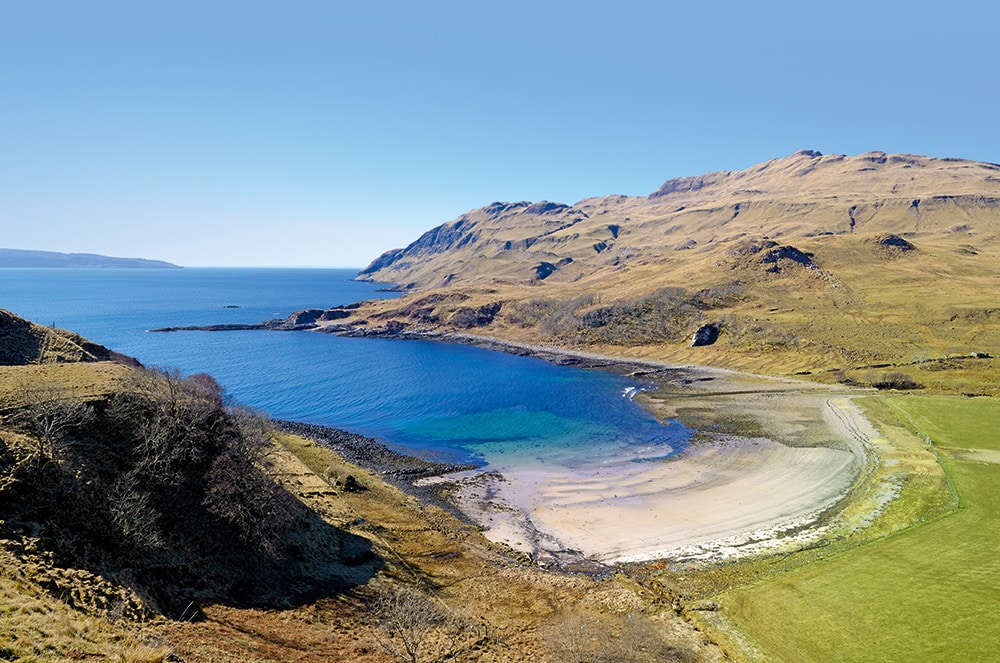
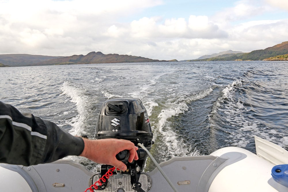
When two days of good weather arrived, I was keen to make the most of them with a couple of day trips on the boat. Resipole’s slipway is opposite its main entrance, making hand-launching (using removable transom wheels) straightforward. With gear stowed and final checks complete, I rowed out a little to deeper water, lowered the engine and pull-started it. Keeping the correct side of the west cardinal marker near the slipway, I headed out alone towards the Morvern Peninsula and continued down Loch Sunart. It felt good being afloat again, and I was soon passing the wooded hillside on the Morvern shore, which makes up the RSPB’s Glencripesdale Nature Reserve. This ‘hyper-oceanic’ zone is part of Scotland’s temperate rainforest and home to a diverse mix of mosses, liverworts and birds. It is remote, with no public road access.
After a bend in the loch, I passed the hamlet of Laga, on the north shore, and was soon motoring between the islands of Carna and the smaller Risga. Archaeological digs on Risga have found heaps of discarded shells and various tools, made from materials including antler and stone, dating back to the Mesolithic period.
Back at Resipole slipway after 2nd day trip.
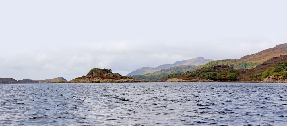
At the northwestern tip of the Isle of Oronsay, I turned back to allow time for a detour to see more of Carna and Loch Teacuis. Rounding the northern tip of Carna, I spotted a red Pioneer Multi boat ahead. It was likely from Ardnamurchan Charters, who hire them out for wildlife spotting and fishing within 3 miles of Laga Bay. I approached the narrows of Caol Charna to the east of Carna, slowly. Graeme and I had seen a porpoise here 10 years ago, but none appeared this time. I passed the island’s three (off-grid) houses close to the shore, two of which are self-catering holiday cottages (which come with their own boats). Carna has been privately owned since 1881, with descendants of the original owner managing the island today. The Carna Conservation Initiative was set up to improve the sustainability (both ecological and economic) of the island and nearby communities. Making sure I avoided the partially exposed Drochaid Charna and other rocky hazards, I proceeded carefully. As Carna almost entirely blocks the entrance to Loch Teacuis, views of it only really appear once you enter, and they justify the detour from Loch Sunart. Inside and glancing back, the change of direction in combination with the topography hid the entrance route, giving the impression I was on an inland loch. Loch Teacuis continues for almost 3 miles and on charts looks like two lochs linked by a very narrow (and shallow) channel. I’d kayaked most of its length on the Plas Y Brenin trip but only visited the outer section this time. The sheltered waters are home to globally rare aggregations of serpulid worms. The groups of tubular shells in which the worms live support other marine species too, offering them a place to attach and grow, or seek sanctuary. They are one of the priority features within the Loch Sunart Marine Protected Area.
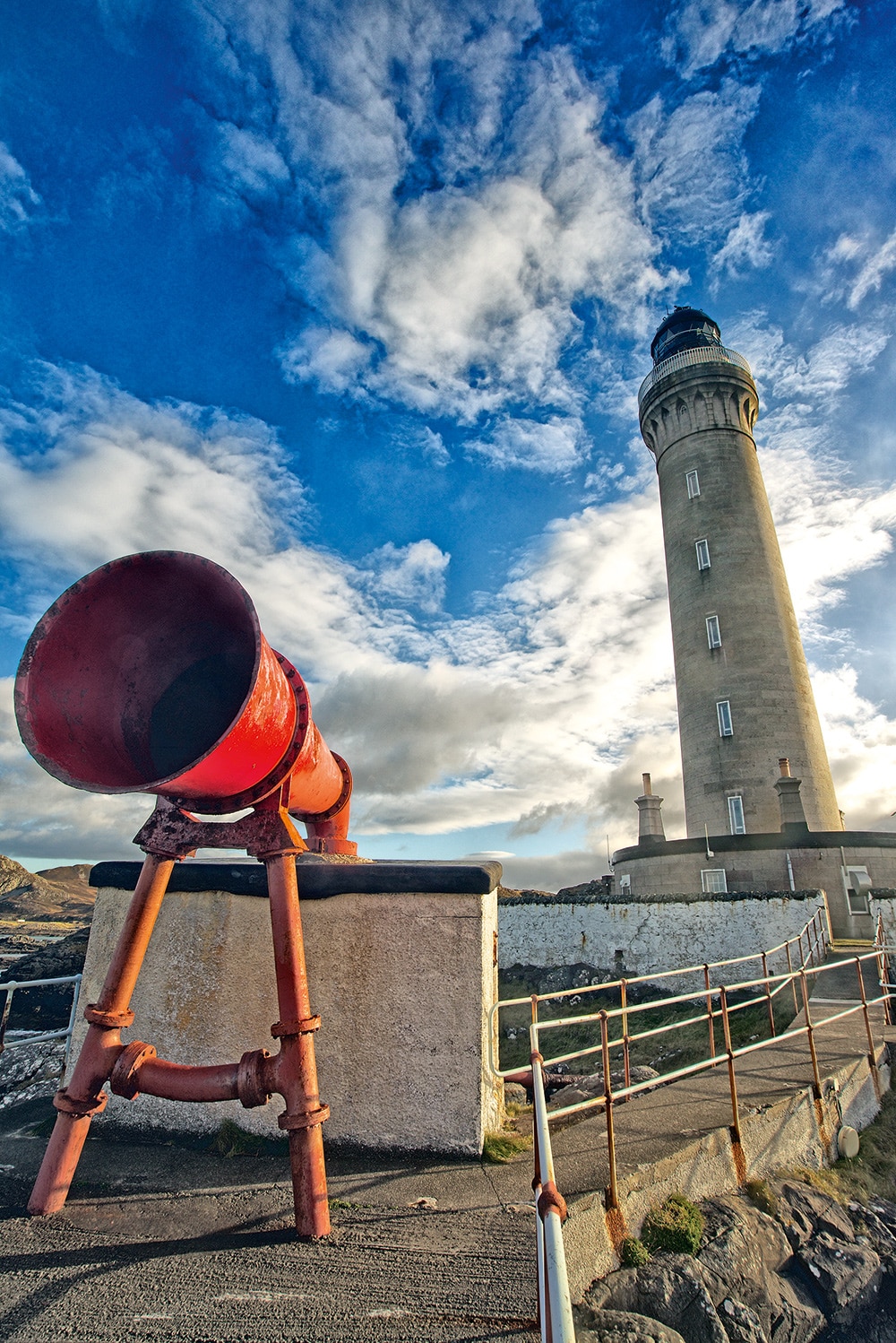
Ardnamurchan Lighthouse and foghorn. © themoog iStock
Isle of Carna, our 1st day trip.
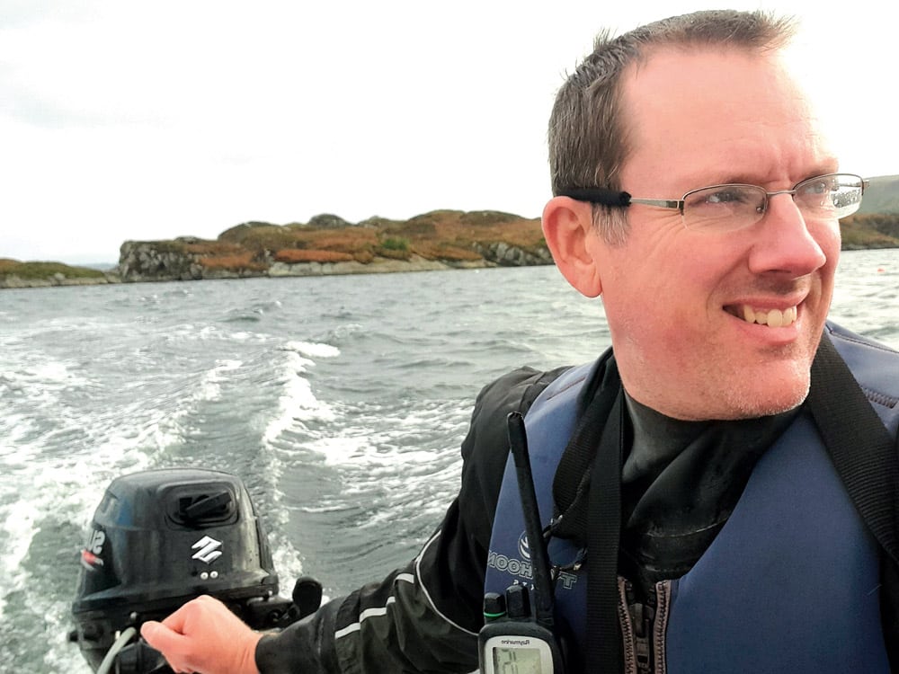
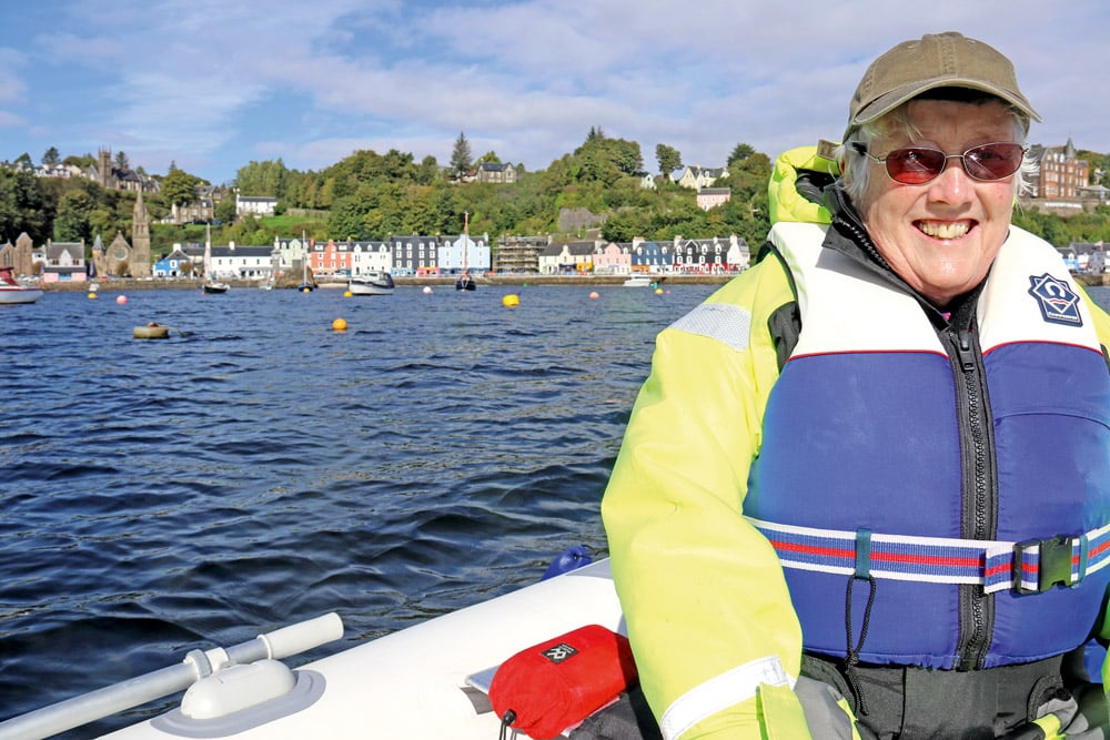
Peter on Loch Sunart.
Leaving Loch Teacuis the same way I’d entered, the sun broke through as I headed east. Behind me, the hills on the southern edge of the Ardnamurchan Peninsula were catching the sun. Travelling nearer the northern shore and past Camas Inas Bay, I decided to call into Salen for the first time by boat. Approaching, I was interested to pass the former sail training vessel and ex-tall ship St Hilda anchored in Salen Bay. I’d seen her regularly on the River Tyne when she was operated by South Shields Marine School. St Hilda, a 54ft-long wooden ketch built in 1973, was designed by G.L. Watson and Co., whose impressive portfolio over the last 150 years includes royal yachts, America’s Cup challengers, RNLI lifeboats and naval vessels. She is now the flagship of ‘St Hilda Sea Adventures’, who purchased her in 2006 and converted her to accommodate six guests for Scottish cruises.
Leaving Loch Teacuis and about to head through the Caol Charna to rejoin Loch Sunart.
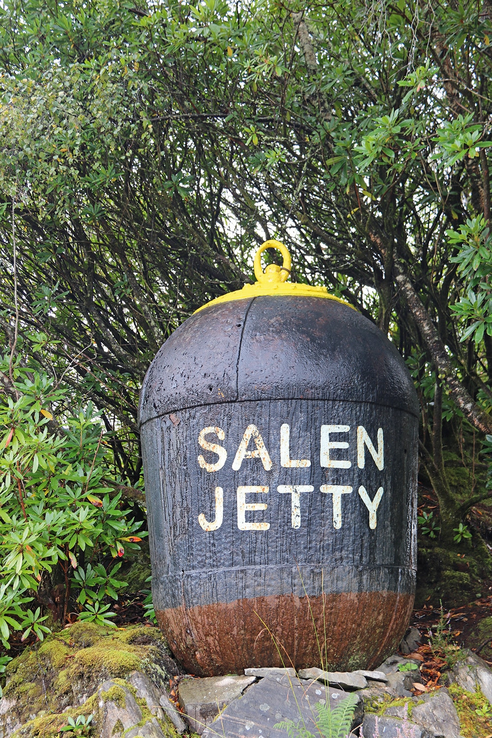
With no one on deck to wave to, I continued in towards Salen Jetty, keeping the east cardinal mark to port. After a brief look at Salen, I headed back into Loch Sunart, turning east and returning to Resipole’s slipway.

Loch Sunart, Ben Hiant in the distance.
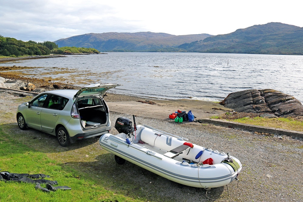
With the next day bringing the best weather forecast of our stay (low winds and sun throughout), Mam decided to join me. Mam has always enjoyed time afloat and had years of boating with my late dad David on his Micro-plus 16 Mk IV cruiser. We planned to retrace part of my route from the previous day, then consider a few options we had prepared, depending on how conditions were. We launched down Resipole’s slipway onto a very smooth surface and were soon making good progress down Loch Sunart.
Ben Hiant overlooking Camas Nan Geall on the Ardnamurchan peninsula, and extinct volcano © iStock/Alasdair James
Beinn Resipol, at 845 metres the tallest summit in Sunart, was clearly visible in the sunshine behind us. In great conditions, we passed Carna then Risga. We noticed a lone seal on Oronsay’s rocky shore and continued down the western side of the island, and along Morvern’s northern coast. Looking north gave impressive views of Ardnamurchan, including the peninsula’s highest peak, Ben Hiant (528 metres), which is part of a former volcano dating back 60 million years.
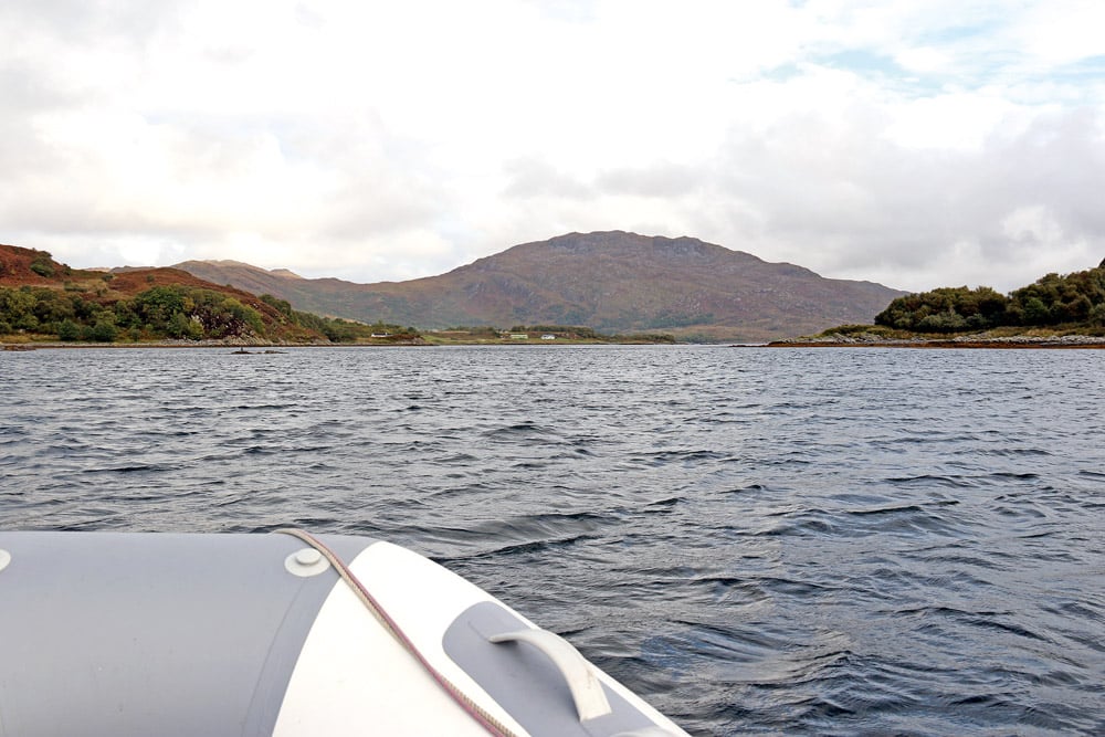
Loch Sunart with Ben Hiant in distance.
Approaching Auliston Point, we paused to watch a seal Mam had spotted swimming astern. Tobermory’s 19-metre-tall lighthouse, built in 1857 and automated in 1960, was visible across the Sound of Mull. With great conditions, a settled forecast for the rest of the day and plenty of fuel, we decided to head across the Sound to Tobermory, the main town on Mull.
We both kept careful watch for other vessels during the crossing and passed south of the ‘Little Stirk’ south cardinal buoy, which indicates the danger presented by several sets of rocks to its north. Entering Tobermory Bay, we exchanged waves with those aboard two yachts flying the flags of Switzerland and Holland.
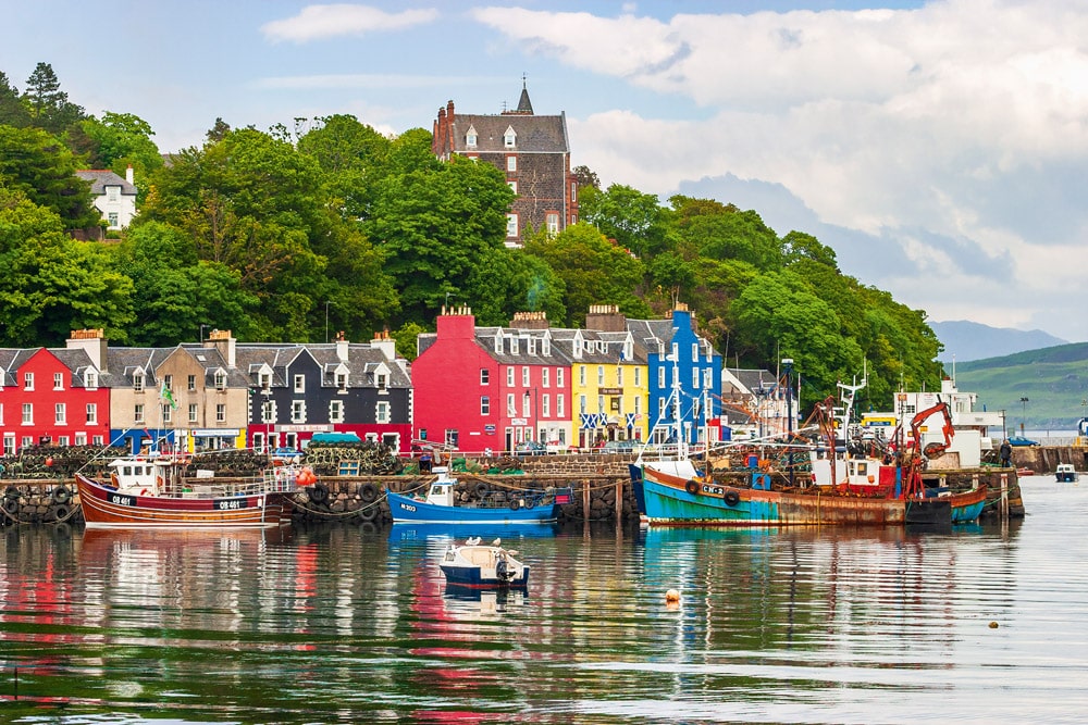
2nd day trip – The very pretty and colourful Tobermory © iStock/ TT
Making our way to the pontoons operated by Tobermory Harbour Association (VHF Channel 68), their expansion since my last visit was noticeable. There are now 60 berths, including space for visiting commercial and leisure vessels. Facilities include toilets, showers, a laundry, a slipway, a chandlery and a passenger landing pontoon (around 40 cruise ships visit each year). Marine diesel is available from both high- and low-flow dispensers, and a garage with petrol pumps lies 100 metres from the pontoons. We stopped and I topped up the main fuel tank from one of our reserves. The famous colourful buildings on Tobermory’s main street looked extra bright in the sunshine. The town’s Severn-class all-weather lifeboat was on its berth near the ferry terminal.
Glenmore Bay, Ardnamurchan, Scotland. © istock/Lukassek
Before long, we decided to start our return journey. While travelling towards the edge of the harbour, we spotted a large bulk carrier heading north up the Sound of Mull, so we kept out of the Sound and waited by Calve Island. The vessel was probably carrying granite from the Glensanda super-quarry, loaded at the deep-water berth on Loch Linnhe. Once it had passed, we started to cross back to Auliston Point, again keeping south of ‘Little Stirk’, and were soon back in Loch Sunart.

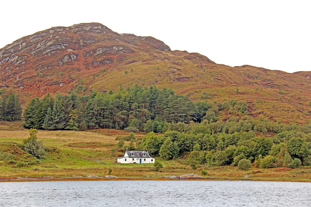
Village of Salen. © iStock/Kevin Alexander George
Still in sunshine, the return journey offered views of the loch, islands and surrounding hills from a different perspective. A large bird we saw above Risga was possibly a white-tailed eagle but was too far away for us to positively identify it. We had to wait a few days more for our first confirmed sighting. We called in briefly at Salen Jetty, before returning to Resipole’s slipway. Mam and I had enjoyed a fantastic day of boating together in great weather. The 33 miles we covered had created some brilliant memories and showed what the region has to offer visiting boaters.
It was great to return to Resipole 10 years on and this time share it with my Mam. Staying longer allowed us to see more of the area and its wildlife (spotting our first white-tailed eagles being one of the highlights). With proper preparation, getting afloat in the region provides unique views of the impressive scenery. The knowledge gained from my two earlier trips (kayaking and boating) helped us make good use of the best weather, visiting locations both old and new. This special region has much to offer those fortunate to visit it.
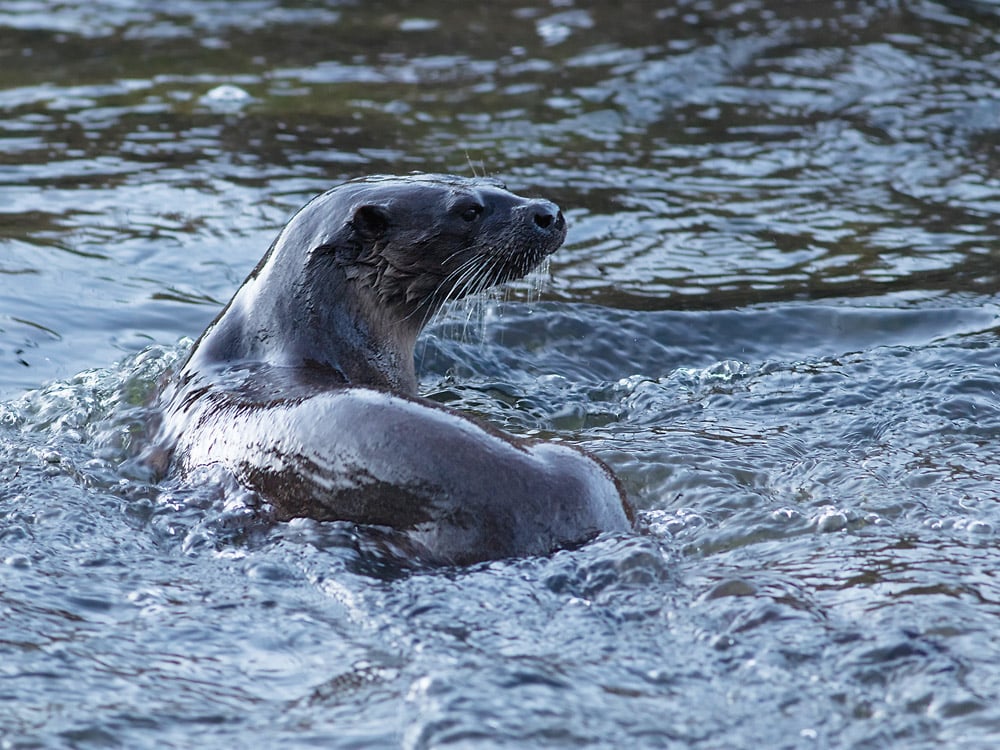
Loch Sunart is a Nature Conservation Marine Protected Area and home to some of Scotland’s most unique marine life, such as flame shells and the northern feather star. Surrounding the loch is the Sunart Site of Special Scientific Interest, which includes important coastal and upland habitats. Large ancient woodlands contain a notable variety of mosses, liverworts and lichens. To increase your chance of seeing some of the region’s wildlife when you are out and about (afloat or ashore), it is advisable to keep binoculars close to hand. Seeing our first white-tailed (sea) eagles was exciting and one of the highlights of our trip, having previously only seen them on television. Even at a quarter of a mile away, the UK’s largest bird of prey species was impressive. It was a privilege to be able to watch these raptors for a little while before they headed off. With their massive wingspan of up to 2.4 metres, they can weigh 7 kilograms. Years of persecution in the UK led to their extinction in the early 1900s, before a successful reintroduction programme (from Norway) began in the 1970s. We were lucky to see two other white-tailed eagles during our visit. We also spotted seals, badgers, a tawny owl and a pine marten. In the holiday park itself, we saw a red squirrel and, late one evening, several red deer including a stag.
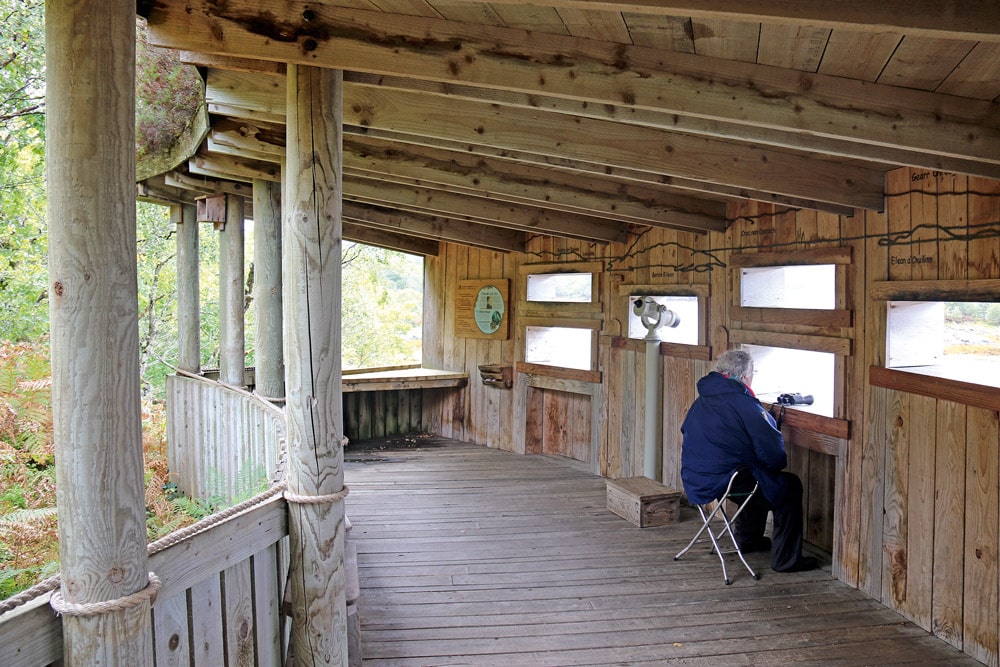
Garbh Eilean wildlife hide.
A couple of miles east of Resipole, the Forestry and Land Scotland’s ‘Garbh Eilean’ wildlife hide offers views over Loch Sunart and Morvern. There is a nature trail at the RSPB’s Glenborrodale reserve, and Ardnamurchan Point has a great reputation for land-based spotting of cetaceans.
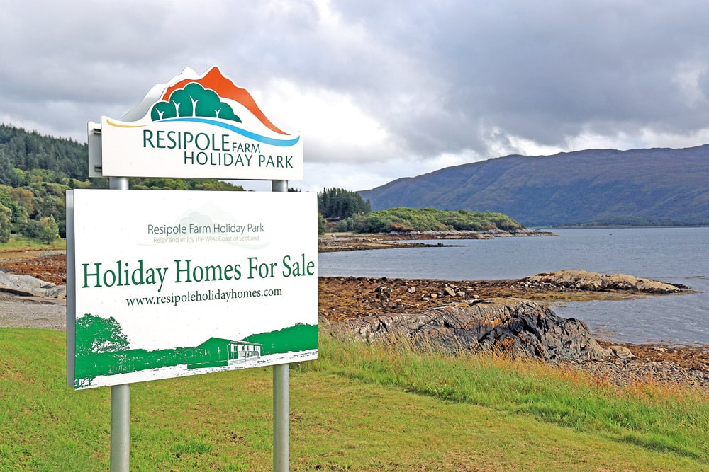
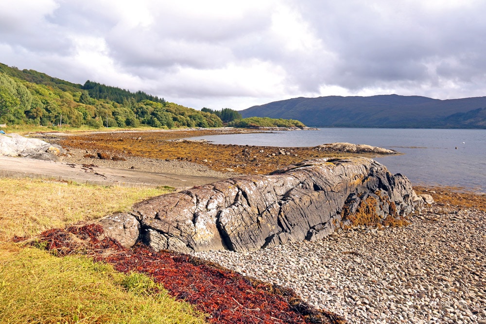
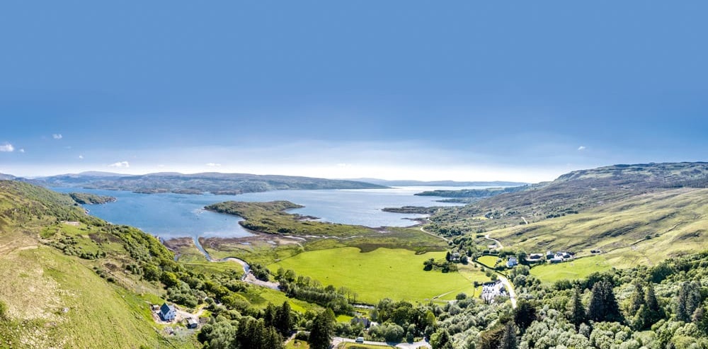
Located on a bend in Loch Sunart, Resipole Holiday Park offers impressive views down the loch and across to the Morvern Peninsula. The park is part of a working farm and spread over quite an area, with separate sections. In recent years, the campsite area, which was nearest the loch, has closed and there are two new lodges in that part. Our lodge was back from the loch, offered plenty of space for the two of us and was comfortable. There is a laundrette (two washers, two dryers) in the reception building and a storage area for boats at the rear of the park. The slipway (concrete running onto a stony beach) is opposite the entrance, across the single-track road. Seasonal moorings are available on buoys a short distance from the slipway.
Loch Sunart – looking back at Beinn Resipol and the hoiliday park.
When I bought my first Zodiac inflatable in 2005, I had been attracted by its portability and relatively low ownership costs. This 2.6m Cadet, with its slatted floor and 4hp Suzuki outboard, could be transported inside my small hatchback, enabling friends to boat with me in a variety of locations. Serving me well over several seasons, it proved that this way of getting afloat worked for me. Since then, I’ve gradually progressed up the range of Cadet and Suzuki models, purchasing them at P.A. Lynch Ltd, where I’ve also traded in my previous boats and engines. I’ve made sure they’ve still fitted inside a car and could be set up and hand-launched alone if required. My engines have all been tiller-steered, with a manual start.
Ten years ago, Graeme and I boated from Resipole in my 3.1m Zodiac, which had wooden floor panels and a 6hp Suzuki. This time, Mam and I had the 3.5m boat with aluminium floor panels and 20hp outboard, which I have owned for a few seasons. The larger boat has more internal space and can carry a larger payload. The vessel’s data sheet indicates that the (Cat C) maximum number of passengers is six, one more than the five quoted for the 3.1m. As with my earlier boats, seating is generally on the Zodiac’s tubes, but when alone, I often kneel or sit on a camping mat on the floor panels. Mam has made a removable foam cushion for the thwart seat, using Cordura-type material. It incorporates three water-resistant, flapped storage pockets.
The additional power of the 20hp Suzuki offers higher cruising and top speeds than my earlier 6hp engine. The 20hp includes battery-less electronic fuel injection and a lean burn control system. Over these two day trips from Resipole, totalling 57 miles, the engine used about 10 litres of fuel, making consumption around 0.18 litres per mile. Cruising speed was around 12mph at about half-throttle.
The safety equipment I carry has evolved over time, influenced by courses I’ve attended, advice I’ve sought, articles I’ve read, new technology and years of boating. It comprises items worn (such as a buoyancy aid, drysuit or Fladen flotation suit) and attached (typically a marine VHF, a PLB, a phone in a waterproof pouch and a knife). Gear on board includes a folding anchor, a sea anchor, extra kill cords, spare rope, a canoe paddle (additional to the oars), a spare propeller and reserves of fuel. Drybags contain the likes of spare warm clothing, hats, gloves, food, drink, suncream, a spare phone, a first-aid kit, a bothy bag shelter, a repair kit and essential tools. The expansion of smartphone apps since my first visit meant I returned to Loch Sunart having used Navionics on my phone for some time. This was very useful on the boat and for planning beforehand. I always carried paper charts on board too. Ordnance Survey maps (and their app) are helpful for planning land-based trips and essential for walks.
The Highland setting and all the twists and turns of Loch Sunart ensure that afloat, there are impressive and varying views along its 19-mile length. Vessels using its waters include commercial traffic servicing marine farms, small cruise ships, tourist craft, leisure yachts and recreational motor craft. At its mouth, the Sound of Mull is a busy shipping lane with the likes of ferries and bulk carriers. Within the loch, islands, marine farms, narrows, shallows, rocks, tidal streams and other navigational hazards require boaters to fully prepare for their visit and remain on top of chartwork and navigation. Roads run along the northern shore, but be aware: the A861 (to Strontian) is mostly single track, and west of Salen, the B8007 is fully single track. The southern shore (Morvern) is more remote, without a public road. As ever, those going afloat need to be aware of their nearest bolt-hole should any problem arise. The weather on the west coast of Scotland can be extremely variable, so boaters need to watch out for quickly changing conditions.
Strontian Post Office and petrol station.
In Salen Bay, roughly halfway along the northern shore of Loch Sunart, Salen Jetty offers nine visitor pontoon berths, moorings, diesel and bottled gas. Other facilities include an all-tide shingle slipway, and ashore there’s storage space for a few boats, a shower room and a toilet. The adjacent Salen Jetty Shop is a friendly, licensed general store and café, and also sells freshly made home-baked produce.
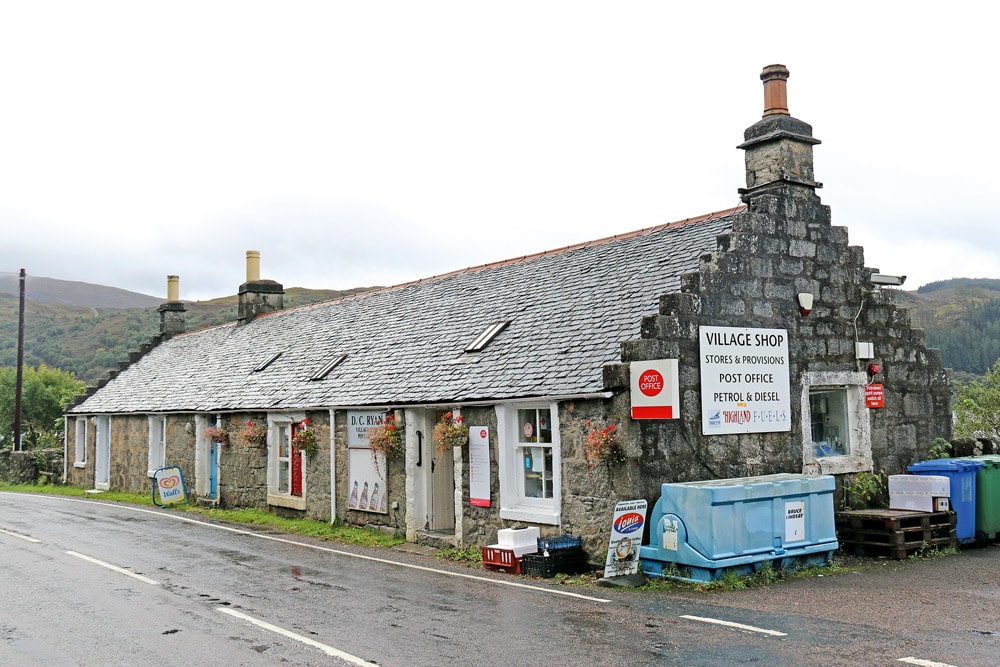
At the eastern end of Loch Sunart, Strontian’s slipway and jetty is run by a local charity, the Sunart Community Company. The slip is free to use (at your own risk), but donations are welcome. Permits for the visitor moorings are available in some of Strontian’s shops, just over half a mile away. Strontian also has the nearest petrol station to Resipole.
PBR features contributor Peter Talbot has owned small Zodiac inflatable boats for almost 20 years, enjoying single- and multi-day adventures in the UK, Norway and Sweden. He’s also helmed inflatables in Greenland, and away from boats, he has completed ski touring expeditions in Svalbard and on the Greenland Ice Sheet and undertaken scientific research on the Ross Ice Shelf in Antarctica.
For those wishing to explore further ashore, Resipole is quite centrally located, offering options by road (mostly single track with passing places) in several directions. While most visitors will have their own vehicle, public transport is provided by Shiel Buses, who operate across the peninsulas (connecting to Fort William), and car hire is available from Loch Shiel Garage (Acharacle).
West of Resipole and Salen, the B8007 takes you past several communities (including Kilchoan, with ferry connections to Tobermory on Mull), viewpoints and beaches to Ardnamurchan Point. Here, at the most westerly point of the British mainland, stands the 39-metre-high Ardnamurchan Lighthouse, built in 1849. The complex is owned by the local community and open to the public. A couple of miles north of Salen is the village of Acharacle, which lies at the western end of Loch Shiel. Nearby, on a small island in Loch Moidart, is the picturesque ruined medieval Castle Tioram. It can be reached on foot via a tidal causeway but is closed to visitors, and signs warn of falling masonry.
Near the head of Loch Sunart, 7 miles east of Resipole, lies Strontian. The chemical element strontium is named after the village, where mineral mining resulted in its discovery. One of its uses is to give marine flares their red flame. Shops include Strontian Stores, along with a tourist information office, a post office, a café and a petrol station (the closest to Resipole). Sunart Camping has camping cabins, plus tent and hardstanding pitches. Nearby, the Ariundle Oakwood National Nature Reserve offers walking trails through rare ancient woodland that is part of Scotland’s rainforest.
South of Strontian lies the Morvern Peninsula, and the route to Lochaline (with a ferry connection to Fishnish on Mull) offers fantastic views of wild, rugged terrain. A couple of miles before Lochaline, the Ardtornish Estate has a farm and gift shop, along with country sports, accommodation and walks.
This content was created by the Powerboat & RIB editorial team.
Advertisement
Rainforests, ancient fiefdoms and tales of pirates mingle with hidden coves, cobb cottages and wooded riverbanks...
This article is part of a paid collaboration with Yacht Havens. A peaceful hamlet On the banks of the River Crouch in rural Essex lies the village…
Join Phil & Jules Keen ribster Phil Dargavel and his wife Jules invite us to join them and their friends…
Here are three more good reasons to come cruising to the beautiful Channel Island of Jersey. Joe Mourant’s top three…