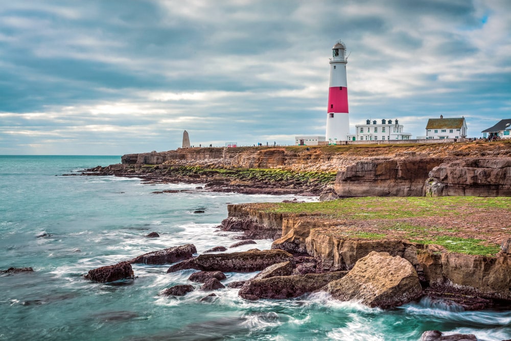
HMS regales us with a unique look at one of the most dramatic sections of coastline to be found anywhere in the British Isles.
We set our Horizon for the Dorset coast …
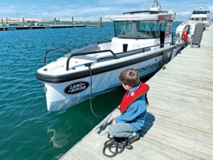
Getting little ones involved at an early age – Portland Marina
If you stand on the high chalkland hills of Dorset, the highest ridge of which forms the much-plied A35 between Dorchester and Bridport, the view southward, over the sweeping valleys and wooded coombes of West Dorset’s countryside, stretches as far as the great sweep of Lyme Bay and the English Channel. If you’re familiar with this scene, you’ll no doubt likely agree that it is one of the fairest of its kind in all of England. On a fine day, if you turn to gaze west, through the haze, out to the blue azure mottled by the breeze-borne clouds’ purple shadowing, you’ll discern the distinctive profile of Golden Cap, the white cliffs of Beer Head and even the red sandstone coast of South Devon. From its eastward extremity at Portland Bill to its westward counterpart of Start Point, Lyme Bay, also known locally as the ‘bay of fog’, spans exactly 50 miles from point to point.
A changing coastland
Some 1500 years or more ago, Dorset’s pre-Saxon inhabitants intensively strip-farmed the ‘highlands’ overlooking Lyme Bay with its vast run of shingle we now call Chesil Beach (a name derived from the Old English ‘ceosel’ or ‘cisel’, meaning ‘gravel’ or ‘shingle’). Indeed, you can still clearly see the impressions and furrows in the land these early Britons carved, particularly in the golden light of a summer’s evening as the sun begins to bow to the horizon and the shadows lengthen. These farmer foragers traded wool too, derived from the hardy flocks they reared and shepherded on the exposed chalk summits overlooking the sea. But today’s gentle landscape of chalk downs and dairy farms disguises the fact that, all those centuries ago, impregnable oak forest, impassable thicket and deadly bog dominated the realms below the hills. People dared not venture down into the valleys for they were the prerogative of such feared creatures as giant boar, brown bear, rock lions and other dangerous, but long-since-departed, native species. These virtually impenetrable lowlands, not surprisingly, were veiled in superstition and myth, and it was not until the early medieval period that resourceful and determined foreigners saw the ‘wild wood’ as something to subdue rather than simply fear.
So it was that the next chapter began, as Saxons replaced the ancient Britons, and along with this morphing, the process of deforestation and land drainage slowly took hold. Bit by bit, the coastal lands were tamed and cultivated until, by the time the Black Death struck in 1348, this area of Dorset had become one of the most farmed, productive and populated regions in the whole of the British Isles.
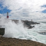
- The bill on a wild day ©PKM1.
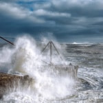
- The power of the race ©MGodden.
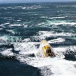
- Image courtesy of Safehaven marine, demonstrating the challanges of motoring through heavy overfalls.
A deadly invasion
Swallowed up long ago by what is now Weymouth, the port of Melcombe Regis lay at the heart of this region and became, perhaps surprisingly, one of the busiest ports in the whole of Europe. A centre for foreign trade and export, Melcombe Regis made Wessex prosperous and its wealthy landowners, men who came to preside over powerful fiefdoms.
Nevertheless, in a swift and unexpected turn of events, the Black Death ended all that. Killing more than half the population, the terrible plague, which had entered the British Isles through Melcombe Regis via a warship returning from Gascony (likely to collect a fresh load of archers for the war in France), went on to irrevocably change Britain’s working and social life from that time forward. With so few men left to work the land, agricultural workers were now a rarity, and hence for the first time in this nation’s history, working people were in a position to demand wages! And with the hundreds of square miles of wild wood now successfully cleared for sheep farming and agriculture, the land, more than ever, needed to be tended and managed to prevent it from rewilding.
Unaware of the bubonic plague’s real cause, namely the rat-infested sailing ships that plied a trade with the Continent, people instead assumed the disease had blown in off the sea, or more precisely Lyme Bay, on the prevailing south-westerlies. Evidence of this can be seen even today, some 600 years later, for if you go searching this region of Dorset, you can still find ancient flint-faced house walls with either their south-facing windows blocked up or the only mullions they do possess resolutely pointing north, away from the restless sea.
The power of the race
In some ways, it is difficult to imagine how and why Melcombe Regis ever became the port it later did, based upon its close proximity to one of the deadliest headlands found not only in the British Isles, but in fact, the world. Truthfully, this is no overstatement. Portland Bill constitutes a giant ‘hook in the tail’, which protrudes right out into the English Channel, mercilessly doing battle with the ocean tides that drag east and west of the rocky bastion. The resulting tide race can rival any maelstrom a mariner will find and outdo most.
I recall RN Commander Richard Bridges once describing to me how, on the fateful night of the 1997 great storm, he was in command of a Type 42 Destroyer that had been deployed to stand off Portland Bill in readiness to give assistance to any vessel caught in or nearby the race as the hurricane raged. ‘I had given the order to steam ahead at full power into the teeth of the hurricane. This was not with the goal of making headway, but rather to maintain our position,’ he said in a calm and understated voice. ‘Despite the twin-system two Rolls-Royce, Olympus TM3B gas turbines delivering their full 56,000shp to the RM1A gas turbines, which in turn were delivering 8500shp to each of the Type 42’s two shafts, we were still going backwards! What was even more concerning was that this reverse motion amid the extreme tide-induced seas was driving the helicopter deck underwater – a situation that, unless resolved, had the very real potential of seriously comprising the entire vessel along with its full complement of crew.’ It’s hard to imagine the pressure Bridges must have been under that night, but his astonishing first-hand account most vividly illustrates the power and ferocity of the Portland Race – a huge and ever-changing, ever-shifting area of turbulent water that has swallowed hundreds of ships and claimed countless lives down through the centuries.
Wondrous sights
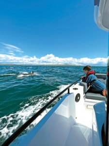
The thrill of watching dolphins playing off the Axopar bow near Chesil Beach, a real treat.
But despite the sobering and fearsome reputation this Dorset headland has, it also boasts a beauty and majesty that cannot be denied. Furthermore, while we mortal and hapless humans endeavour to master the water’s surface, beneath its ocean swells and foaming, breaking wave tops exists a world that the creatures of the deep favour – indeed, come to revel and feed so generously within.
On our voyages this year aboard PBR’s MY Horizon, we have found nowhere else as abundant and seemingly rich in marine life as the seas off Portland Bill. In fact, we have had the privilege of catching some of the most incredible dolphin sightings we’ve ever had the pleasure of seeing, right here in the waters just west of the race. Their breaching and leaping, their racing and playing, alongside and ahead of Horizon’s bow, has been breathtaking.
Common dolphins (also referred to as ‘short-beaked common dolphins’) are an offshore species but often come close to shore to feed. Durlston Point, a little further up the Jurassic Coast, east of Portland, is another well-known location for sightings of these wonderful creatures. They are, of course, much loved for their highly social behaviour, and, just as we experienced, are frequently found in groups. Common dolphins, like their larger cousins the bottlenose dolphin, are sea mammals that feed mainly on fish such as sprats and herring. These migratory fish stocks have been abundant in our Channel waters this season and are likely the reason why so many bluefin tuna have also been sighted in recent months.
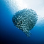
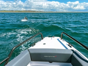 With their highly advanced ability to communicate and work in unison as a single group, dolphins will typically coordinate their hunting missions in order to herd their prey into a ball. Portland Race is perfect for this activity, as the fast-moving currents, which can reach a mighty 12 knots at the height of a spring tide, are an environment within which shoaling fish love to congregate en masse in order to likewise feed.
Capable of reaching speeds of up to 30mph, our playful friends are not only highly effective predators at these speeds, but as we know, they’re also perfectly capable of keeping pace with most powered craft and love to course along in a boat’s bow wake. It’s important, however, if you are fortunate enough to experience such a display, that you maintain a steady course to ensure your helming is predictable and constant, so as not to endanger the dolphins when in close proximity to your boat.
From the skies above
Without doubt, the largest, most dramatic and most extraordinary seabird gatherings I have ever seen offshore in all my 40 years of boating have been witnessed this year in the waters of Portland Race. In June of this year, we were rounding the Bill heading eastward, taking the inshore course beneath the shadow of the lighthouse on a flood, wind-against tide. The day was bright, and the sea sparkled in the afternoon sunshine. The race could be clearly seen stirring strongly directly south of us about half a mile offshore, and it was interesting to note that the tidal eddies and overfalls were not congregated in a single area. There were pockets of ‘stretched’ water where the swells were longer and the seas less prone to breaking.
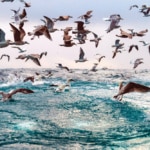
But among this portrayal of power and natural beauty was the most startling sight of all. Thousands of seabirds of every description, from tern to gannet, kittiwake to herring gull and shearwater to guillemot, were amassing as one huge harmonious flock, over and upon the surface of the frothing waters. Utilising every vocal range imaginable, they shrieked, cried and squawked as they dived, circled, alighted and fought for the chance to take their place among the mighty throng!
- Gannets & Gulls in the overfalls ©piola666
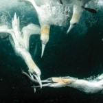
- Gannets plunging into the sea to feed.
- Fish bait ball. ©naturepics-Li
What had summoned this great multitude of such diversity to the boiling, silver feast gathered directly beneath the race’s curling crests? From how far away had these birds flown before swooping in for the feast, and just how was the news spread so quickly and efficiently throughout the winged community? I wish I knew, but I’m certain that they were descending upon a giant shoal of bait fish – perhaps sand eels, maybe sprats or even anchovies. It’s impossible to know, but one thing is for certain: the Dorset coast, both rich in history and abounding in beauty, is a place of true natural wonder, and at times, unbridled power – a seagoing adventurer’s dream where the past collides with the present, and where expecting the unexpected is the rule for every exploration or journey planned.
Pilotage through the race
Portland Race lies to the south of Portland Bill and can be so violent as to make it a serious undertaking for any leisure craft attempting to traverse it. The options, therefore, for avoiding Portland Race are either to pass well clear, offshore of the area, or to take the inner passage between the Bill and the race. The safest route is to stand well out and give the Bill a good 3-mile berth, but if you take a leaf out of the book of the Cowes–Torquay powerboat racers, you’ll find that there is another course to steer, one that necessitates you virtually kissing the rocks beneath the lighthouse. This is the inner passage and has been used by some even amid inclement and testing conditions. Admittedly, it’s best to use the latter on a neap tide in daylight as it requires precise visual pilotage and the ability to maintain transits to identify any southward drift and to avoid lobster pot buoys.
The Bill’s dynamics
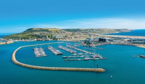
Isle of Portland from the air. This picture shows the marina, sea, sky and port.
Portland Bill is a narrow promontory (or bill) at the southern end of the Isle of Portland, and the southernmost point of Dorset. South of the Bill lies Portland Race, in which severe and very dangerous sea states can occur. The navigation resource www.eoceanic.com provides the following enlightening details regarding the race, its geological features and the effects that the convergence of three tidal dynamics have on this sea area:
Flanking bay eddies: Very strong south-going currents run for 10 out of 12 hours along the east and west sides of Portland Peninsula to converge just south of the Bill.
Portland Ledge: This is a shallow ledge that extends 1¼ miles southward of the Bill. A quick look at the chart will show that to the south-west of the Bill, the depth steps up from about 60 to 80 metres to from 12 to 5 metres in less than a quarter of a mile. The main body of the east–west-going English Channel streams is forced to ride up over the uneven and shoaling bottom, causing turbulent seas.
Strong tidal streams: The peninsula compresses the channel tidal streams, vastly accelerating their velocity, and a ferocious tidal stream sets off the Bill during spring tides. Streams attaining 7 knots in the direction of the main current are charted in the tidal atlas, and flows of 10 knots have been found in, and close by, the race.
If in any doubt about the conditions, call Portland MCI, who overlook the location, on +44 1305 860 178, from 7am to 7pm daily during the season. They also maintain a VHF 16 watch.
Dolphin identification
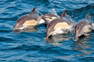
Wild Common Dolphin playing and breaching in the waves together
Slender in form, the common dolphin’s marking is dark grey above and whiter below. Common dolphins also have a distinctive hourglass pattern on their sides, including an obvious yellow-cream area starting behind the long, narrow beak. The dorsal fin is tall and triangular and curves slightly backwards. They are a species that can be found all around the UK, usually off southern and western coasts, but also offshore.
How you can help
Report your marine wildlife sightings to your local Wildlife Trust. If you meet common dolphins while at sea, maintain a distance of at least 100 metres, especially if calves are present. If the dolphins approach you, maintain a constant speed and allow them to interact on their own terms and leave at will. If you find a stranded common dolphin (dead or alive), please report it to the relevant authority. The Wildlife Trusts are working with government to find solutions to fishing bycatch across all marine species. You can support our work by joining your local Wildlife Trust and by choosing sustainably sourced seafood.
See www.wildlifetrusts.org for further information.
The high road by the sea
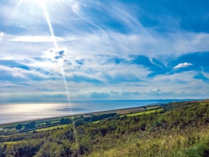 Along the high road by the sea, through windswept pastures green
Beside fifty miles of wide-mouthed bay, you’ll find no fairer scene.
From Start Point in the west then to the east, Portland Bill
Until the tide does turn again these waters will lie still.
Glinting, liquid mercury, silver ocean swells
Such welcome springtime sunshine, this shimmering glory quells.
Any fears the vista’s mood could change for weather foul
Hard to picture here in winter when winds they snarl and growl!
Biting, fierce but splendid with seas that crash upon
Chesil’s heaped-up beach of pebble some eighteen miles long.
But on this day so fine and clear, finches dance the salty air
Their happy chatter seems, for all the world, devoid of any care.
Upon this high land crowned by gorse and wind-bent thorny tree
Is where you’ll find the fairest road, out east to Abbotsbury. HMS
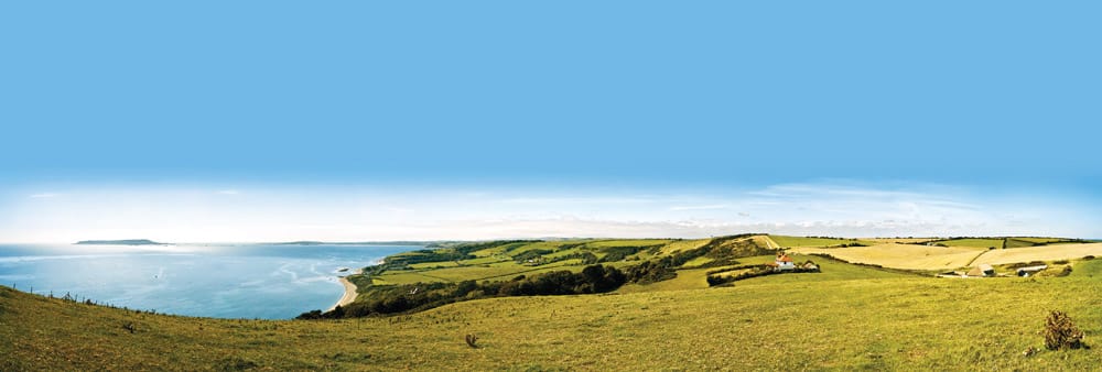
Views from the south west coast path over the dorset coast at ringstead bay

