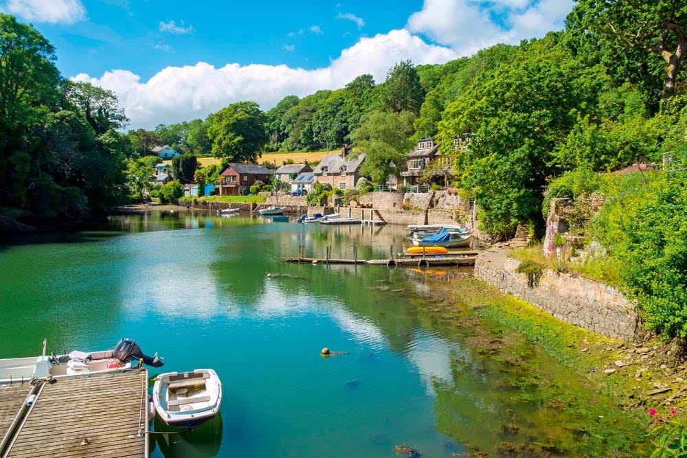
River of Dreams – Helford River
Rainforests, ancient fiefdoms and tales of pirates mingle with hidden coves, cobb cottages and wooded riverbanks...
Advertisement
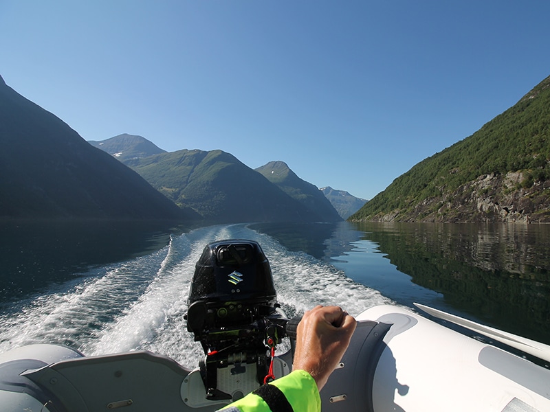
Avid inflatable boat owner Peter Talbot tells PBR about touring over 250 miles in Norway’s Storfjorden and five of its side fjords. His adventure included cruising the famous Geirangerfjorden, recognized by UNESCO as ‘among the most scenically outstanding fjord areas on the planet’, boating alone in his Zodiac after unexpectedly finding himself without a crew …
‘Bad news … I’m in hospital … Clearly won’t be seeing you tomorrow … I’m out of action for six to eight weeks.’ Opening Tom’s email while waiting to board a car ferry from Denmark to Norway, the news came like a bolt from the cloudless blue sky above. Thoughts raced through my head. Had I misread it? Was Tom going to be OK? What had happened? Then after that, I wondered how this would affect the trip we’d planned together.
I’d left Newcastle three days earlier on an overnight car ferry to Amsterdam, then spent two days driving to Hirtshals at the top of Denmark, via Holland and Germany, camping near Hamburg, then Hirtshals. Tom had booked flights so we’d arrive in Oslo together and drive north for just over a week’s boating. Following his accident, Tom was now awaiting surgery on a torn bicep, and wouldn’t be fit to boat for some time. Both disappointed, we wished each other well, saying we’d keep in touch.
Before I lost the signal crossing the Skagerrak to Norway, I contacted those friends I thought had the best chance of getting to Oslo in the next 36 hours, realising it was a big ask.
Advertisement
Having previously boated and camped round Hardangerfjorden in my 3.1m Zodiac with my friend Graeme (PBR Issue 124), I’d been keen to return to Norway. Boasting the longest coastline of any European country, with over a thousand fjords, I’d narrowed the almost limitless options by identifying fjords regularly featuring on ‘most scenic’ lists. Examining those with some interconnectivity, I was drawn to the large Storfjorden near Ålesund. Looking at the distribution of campsites, access points and petrol stations, I’d spotted the centrally located campsite at Stordal, complete with harbour, giving plenty of boating options north and south. Having boated between campsites on ‘A to B’ journeys on most previous trips, Tom (whom I’d boated with in Greenland – PBR Issue 140) and I had discussed the benefits of using Stordal campsite as a base. The benefits of this over an ‘A to B’ journey included: giving us options for varying weather, the chance to revisit spectacular areas (rather than getting ‘one pass’) and not having to carry the camping gear on board (making us lighter, with the time saved on setting up/striking camp giving us more time afloat). Not having to retrieve the car left at A once we’d got to B would likely give us a full day extra on the boat. As well as day trips from Stordal, we’d have options for longer trips such as staying overnight in Geiranger. Tom was only able to set aside just over a week, so as I’d be in Norway for longer, I’d researched the campsite at Tingvollvågen on Tingvollfjorden as an option to move to (by car) after Tom had left, if I wanted.
Arriving in Larvik on the ferry, I drove east to Drammen, negotiating my first ever underground roundabout, in the city’s road tunnels, on the way to the campsite. Unsurprisingly, my text messages had drawn a blank (interested parties were unable to get time away at such short notice). I decided to head to Stordal, where my planning had been focused, rather than Tingvoll.
Passing underneath Oslo’s centre through tunnels, I made good progress. The road was soon following rivers and lakes, through interconnecting valleys and north via Lillehammer (home to the 1994 Winter Olympics), Otta, Dombås, and then through the spectacular Romsdalen valley, which includes the famous Trollveggen (Troll Wall), and into Åndalsnes. It was then only an hour’s drive west to Stordal.
Advertisement
On my first morning in Stordal, after obtaining some local knowledge from Ilyas (the son of the campsite owner), I launched and moored to the visitors’ pontoon in the harbour. In bright sunshine, and with a good forecast, I filled the fuel tanks at the village petrol station and set off for a shakedown cruise. Stordal nestles on the east side of Storfjorden, in Stordalsvika Cove, which is about 1.5 miles long and 1 mile wide. After 10 minutes I was in Storfjorden proper, admiring the spectacular all-round view for the first time. Deciding to limit this first trip to two hours, I headed north thinking the few villages and the road along the east/north shore would offer safe-haven options if needed. Passing Dyrkorn (near where Storfjorden is deepest, at 2,228ft), I noticed the remote historic farm of Ytste Skotet, high up across the fjord. After an hour, I crossed the 2 miles to the southern side, tracing it back under the shadow of the 500m hills. Opposite Stordal, I passed a few remote houses/cabins on the hillside, presumably holiday or weekend homes, some with pulley systems for getting supplies up from jetties. Crossing back to Stordal gave impressive views south towards Inner Storfjorden. Interestingly, on this 20-mile trip I’d counted only seven boats out and about enjoying the fine weekend weather.
The following day a stiffer westerly breeze was generating some chop in the centre of the fjord, so I limited my boating to a 10-mile return trip to Dyrkorn. On the way I saw salmon jumping in Storfjorden, adding to herons, oyster catchers, swallows and pied wagtails I’d already seen in the area. The wind eased a little the next day, so in continuing sunshine I decided to make my first trip south towards the village of Stranda. Having crossed the fjord into a little bit of swell, just past a fish farm I noticed what looked like a small hydroelectric station and continued south with the wind on my back, keeping fairly close in for calmer conditions. Assessing the conditions at Stranda, I decided to continue south-east and cross into Norddalsfjorden. Looking south into Sunnylvsfjorden as I crossed its mouth, I saw the route I hoped to take to Geiranger at some point. Entering Norddalsfjorden, I passed the impressive rock cliffs of Skrednakken and continued to the small village of Eidsdal, where three car ferries were connecting road 63 across the mile and a half of fjord between Eidsdal and Linge. After a quick look around, I crossed to the north side of Norddalsfjorden, with a little wind on my nose, until Stranda, retracing my route back to Stordal.
Having enjoyed three days afloat, and with the following day bringing the only rain forecast for the foreseeable future, I visited Ålesund (a one-hour drive away). The largest town in the county (population 47,000), Ålesund is built on a series of islands and is an important fishing port. As a result of the town having to be extensively rebuilt following a fire in 1904 that almost destroyed the wooden town in a single night, Ålesund has some of the best examples of art nouveau architecture in Norway. One art nouveau building worth a visit is Sverre Eidsvik’s superb traditional ship’s chandlery (established in 1931), packed to the roof with everything imaginable. Near the city centre, the 418 steps to the Aksla ‘town mountain’ viewpoint provide great views, and a short drive away, the Sunnmøre Museum is worth a visit.
Advertisement
Back in Stordal, I checked forecasts, starting to think of my trip to Geiranger, and made a few tentative enquiries regarding accommodation. At 35 miles, the outward route was only a mile longer than my return trip to Eidsdal, but with the only harbour and feasible road access past Stranda (until Geiranger) being at/near Hellesylt, the relative remoteness of Sunnylvsfjorden and Geiranger made the trip feel more committing. The shorelines past Stranda were steep, with some stretches of very steep or vertical rock faces that would make progress on foot challenging at least.
With a forecast for north-westerly winds of a maximum 5 miles per hour, I made an early start from Stordal, crossing Storfjord into a slight chop, before heading south. Within an hour I’d passed Stranda, reaching the small light at the mouth of Sunnylvsfjorden. Layers of broken cloud partially obscured the surrounding mountain tops, giving Sunnylvsfjorden a ‘lost world’ appearance. The 12 miles down this stunning fjord were a real highlight and were completed without seeing another boat on the water, though I did notice a small number of empty-looking cabins on the shores. After the dry summer, the previous day’s rain swelled the waterfalls I passed on both sides.
Crossing to the mouth of Geirangerfjorden, I could see that conditions inside were even better. Clouds still brushed the tops, but didn’t obstruct the views of the magnificent Seven Sisters waterfall, and opposite, the Bridal Veil waterfall. The snake-like twists of Geirangerfjorden created a varying panorama, with the village of Geiranger only coming into sight after the last bend. With several stops for photos on the way, the trip from Stordal had taken three hours.
When I’d contacted Solhaug Camping previously, asking about the availability of cabins (before knowing exact dates), Gunn had recommended calling to check on arrival. Stopping off on the southern shore opposite Geiranger, Gunn was very helpful and, after first trying to move bookings around to free up a cabin, kindly rang a friend in Geiranger, securing me a room in her guesthouse. Arriving at Geiranger’s visitors’ pontoons, the friendly owner of a large motor boat identified a suitable mooring near his bow. Mooring fees equated to £5 a night (payable at the nearby café), and I caught a bus up the hill to the guesthouse, discovering my room had a brochure-worthy view down onto Geirangerfjorden.
Geiranger’s population is around 250 in winter, when locals say the town ‘sleeps’, but with approximately 150 cruise ships visiting from around May to October, the number on some days can reach 8,000. Anchoring close to the village in deep water, passengers can use Geiranger’s ‘SeaWalk’ floating walkway to get ashore. The village is compact, with shops, supermarkets and tourist facilities centred on the shoreside. Uphill, exhibitions in the Norsk Fjordsenter showcase the history, culture and wildlife of the West Norwegian Fjords World Heritage Site. The problems of landslides in Inner Storfjorden are highlighted (there have been more than 100 since the last ice age). In 1934, three million cubic metres of rock fell into Tafjorden, causing a wave up to 62 metres high, which tragically killed 40 people in Tafjord. Currently, the Åknes rockslide (in Sunnylvsfjorden) is being closely monitored, with concern that up to 54 million cubic metres could fall, causing a wave up to 40 metres to hit the villages of Hellesylt and Geiranger. Another location in Tafjorden is also being closely monitored.
Advertisement
After deciding to stay for a second night, the next day I boated to Hellesylt, on a mirror-like fjord, in bright sunshine, seeing craft ranging from cruise ships to kayaks, before returning to Geiranger.
Heading back to Stordal the next day, Sunnylvsfjorden appeared even more spectacular in the bright sunshine. It transpired later that a cruise ship I noticed a few miles away near Hellesylt had friends of a friend on board – like me hugely enjoying the weather and scenery. At the junction with Norddalsfjord, in perfect conditions and with plenty of fuel, I decided to turn east and travel along Norddalsfjorden, then Tafjorden to the village of Tafjord. Tafjord holds several ‘warmest’ records in Norway. After a brief stop, I headed back towards Stranda, this time travelling up the east shore of Storfjorden and reaching Stordal, five hours (and 62 miles) after leaving Geiranger.
Having seen a lot of Inner Storfjorden, I chose to see more of Outer Storfjorden in my time remaining. After reading about Hjørundfjorden with its views of the Sunnmøre Alps, I headed there the day after returning from Geiranger. Crossing Storfjorden from Stordal, I was soon travelling westwards, past where I’d reached on my shakedown cruise, and I saw my first porpoise soon after passing the mouth of Sykkylvsfjorden. The mountains lining Inner Storfjorden are replaced in Outer Storfjorden by generally lower peaks with more frequent gaps, allowing wider views of the surrounding area.
Advertisement
At 2 miles wide, Storfjorden was now approaching its widest point. With the weather still perfect, I headed south into Hjørundfjorden and crossed to its western shore. The jagged peaks of the Sunnmøre Alps, some still with snow on, became more visible. The English climber William Cecil Slingsby, a climbing pioneer in Norway (first visiting in the 1870s), said of the views from Slogen (a mountain near Hjørundfjorden): ‘You will never see another such view.’ I travelled 6 miles down Hjørundfjorden until level with the small village of Ytre Standal. Aware I was around 30 miles from Stordal, and wondering if the good weather was still holding in the more open Outer Storfjorden, I paused only briefly for some photos.
Moving over to the east side of Hjørundfjorden, a porpoise appeared several times fairly close to the boat. On reaching Storfjord, the weather appeared unchanged; however, after a couple of miles the wind started to increase from the east/south-east in some fairly strong gusts, and small waves were soon building. Knowing the northern shore had more safe havens, access to a road and was ultimately on the same side of the fjord as Stordal, I quickly decided to cross the couple of miles to it in case conditions prevented me doing this later. Keeping at an angle to the waves, rather than having them beam on, I noticed there were a few more whitecaps. Safely on the other side, conditions improved a little. Looking across the fjord, I suspected the gusts were coming through a gap in the mountains, behind Sykkylven, so I thought they’d drop a few miles east, once past the ‘gap’. I noticed the gusts hitting my face seemed distinctly either warm or cold. Having felt this variation several times, the warmer gusts appeared stronger, having a greater effect on the water and boat. Intriguingly, the temperature I felt on my face as the gust reached me therefore seemed to give a crude indication of its strength before it fully hit. The wind dropped as I made my way east, backing up my ‘gap wind’ theory.
A sting in the tail awaited in Stordalsvika Cove, where I experienced the strongest winds of the entire trip, right on the nose. Acting over only the mile and a half from Stordal, the waves weren’t too significant and lessened with decreasing fetch as I closed on Stordal. The winds on my return journey hadn’t been enough to cause a change of plans or to make me wait in a safe haven, but it had been an interesting end to another long day trip, totalling 61 miles. Back at the campsite, I added pegs to a neighbouring tent (whose owners were away), which looked in danger in the gusts. On my last day afloat, I had a shorter round trip of 11 miles, across to see the pontoon near the historic farm of Ytste Skotet. With the weather looking to be changing, I didn’t want to leave the boat to look at the farm, and returned via Dyrkorn.
After eight days of boating, I took the boat from the water and started packing up ahead of the journey back to the UK.
Advertisement
My 3.4m Zodiac and 20hp Suzuki combined to impress me in the range of conditions I experienced over the 256 miles I covered. My central base at Stordal Camping allowed successive trips that increased my knowledge of Storfjord, which was useful for the following trips. While experiencing the scenery was always more important than clocking up mileage, I averaged 32 miles per day over my eight days of boating, including two consecutive 60-plus-mile days.
In my experience, the western fjords are well set up for people wanting to visit, especially by boat. Camping, and taking some food from the UK, is significantly cheaper than using hotels, with the return journey from the UK being the biggest component of the overall trip cost (two return car ferries and fuel for the 2,300-mile car journey). Campsites regularly have direct or close access to the water and sometimes have harbours.
Overall I was fortunate with the weather. In Norway, it only really rained on one day, winds varied but never really affected my plans and often the fjord was like glass. Temperatures in Stordal reached 31 degrees Celsius – much hotter than the 12 degrees Graeme and I had experienced a few years earlier in Hardangerfjorden at the same time of year (which had been unseasonably cold). My three-day return trip to the village of Geiranger was a major highlight. The remoteness of Sunnylvsfjorden, coupled with it being a key part of the route to Geiranger, made it narrowly my favourite.
The scenery lived up to its reputation and the experience of travelling through it exceeded my expectations. This made all the preparation time, travel and effort I had invested in the three-week adventure, from dreaming up the idea to arriving home, definitely worthwhile. Norway’s western fjords are simply magnificent.
Advertisement
Located at the end of the Stordal valley, on the eastern shore of Storfjorden, the small village of Stordal has a population of just over 1,000 people. Stordal’s community has traditionally farmed the local land (mostly pastoral) and manufactured wooden furniture. The compact village centre includes shops, two supermarkets, tourist information, a bank, a petrol station and a fjord-side quay. Stordal’s wooden ‘Rose Church’, built in 1799, is one of Norway’s most decorated and is now a museum, having been superseded by a larger church in 1908.
The harbour, surrounded by wooden boathouses, has long-term pontoon moorings for approximately 50 local boats. Along with facilities you’d expect, such as a slipway and electric hook-up, pipes beneath the pontoon emit air bubbles in winter, which rise, stopping ice forming around the boats. Mooring to the separate visitors’ pontoon (capacity around 15 vessels) for a boat like mine equated to £4.50 per night, seven nights for the price of six, payable in an honesty box.
Advertisement
With space for tents and motorhomes, and with cabins and an apartment to rent, Stordal’s campsite is well run by Siri, and is situated just behind the harbour, boasting great views looking up the valley. Siri and her family also run the Nilsgardtunet restaurant in Stordal, in what was their family’s farmhouse when they previously ran a dairy farm. Camping cost me the equivalent of £10 per night.
At 68 miles long, Storfjorden (Great Fjord) is one of Norway’s longest fjords. Winding inland from its mouth (where Sulafjorden and Vartdalsfjorden meet), 7 miles south of Ålesund, Storfjorden branches into several side fjords. The main branches in Outer Storfjorden are Hjørundfjorden and Sykkylvsfjorden, and in Inner Storfjorden, Sunnylvsfjorden (which leads to Geirangerfjorden) and Norddalsfjorden (leading to Tafjorden). Located in the Sunnmøre region of Møre og Romsdal, the villages along Storfjorden aren’t heavily populated (the largest being Sykkylven and Stranda with populations of 4,258 and 2,907, respectively). A network of roads and car ferries, some of which are closed or don’t operate during winter, connects the villages. The mountains surrounding Storfjorden vary from up to 2,500ft near its mouth, rising to almost 6,000ft near Geiranger and Tafjord. The deepest part is near Dyrkorn, where depths reach 2,228ft.
Geirangerfjorden and Naerøyfjorden (75 miles away) were chosen to represent the West Norwegian Fjords on the UNESCO World Heritage list, being ‘considered to be among the most scenically outstanding fjord areas on the planet’. UNESCO also points out that ‘of the 200 fjords along the west coast of Norway, Naerøyfjord and Geirangerfjord are the least affected by human activity such as hydroelectric dams and infrastructure’ (in all my boating, I have never seen any litter in the fjords). The varying habitats of the Geirangerfjorden area are home to a rich assortment of wildlife, including Norway’s four types of deer (red deer, reindeer, roe deer and the rare elk), pine marten, black grouse, goshawk, wolverine, stoat and, in the fjords, harbour porpoises.
Advertisement
Getting to Norway from the UK by car was made more difficult 10 years ago when the Newcastle to Bergen passenger/car ferry ceased, having operated in various guises for 140 years. My chosen route was the overnight DFDS ferry from Newcastle to Amsterdam, followed by a two-day drive to the Color Line ferry from Hirtshals at the top of Denmark to Larvik in Norway. I’d used the Harwich to Esbjerg (Denmark) ferry twice previously, before it also ceased. I had a daytime four-hour crossing from Hirtshals to Larvik (twice previously the outward leg has been overnight).
Alternatives include driving via the bridge/tunnel that connects Denmark to Sweden, or using the overnight ferries from Kiel in Germany to Gothenburg (Sweden) or Oslo. I used the bridge/tunnel on a trip to Sweden previously. I’ve not used the ferry options from Kiel, but by travelling overnight you’d likely reduce your overall journey time. The cost of a return ticket could be partly offset by the reduction in your fuel bill (fewer road miles) and the money saved on two nights’ accommodation (you get a cabin on board both ways) and not having to pay alternative ferry/bridge/tunnel charges. Your optimal route will depend on several factors, including your starting/end points, available time and if you want to see anywhere particular on the way. Being able to share the driving may increase your daily mileage, but it’s important you’re realistic. I’ve found pre-booking ferries cheaper, but ensure you’ve enough flexibility built into your schedule for unexpected events (such as heavy traffic round cities, roadworks or a flat tyre), which could otherwise put you under pressure, which can be dangerous.
Advertisement
My time on Storfjorden differed from earlier adventures in my boats in several ways: for example, more days afloat, cruising further in a larger boat with a bigger engine and experiencing more remote fjords. The biggest difference was being single-handed after Tom unexpectedly had to pull out late.
I’d identified the relative remoteness of parts of Storfjord early in my preparations. Online maps, satellite images and photos showed Sunnylvsfjorden and Geirangerfjorden’s frequently very steep fjord sides (parts looking inaccessible even on foot), with stretches of over 10 miles having no feasible road access. I’d highlighted safe havens and accessible roads on laminated maps (the nearest roads sometimes weren’t, being the wrong side of 4,000ft peaks or concealed in tunnels), along with buildings (even isolated ones) and areas of particular remoteness. This ensured I’d have this information available on board, and the research helped build up my knowledge. Safety kit assembled over the years was supplemented with recent additions, including a FastFind EPIRB, a throw bag and a canoe paddle ‒ plus a recent ‘Sea Survival’ course (PBR Issue 150). Having borrowed a Fladen flotation suit for an earlier Greenland expedition, I’d found it robust and comfortable on long and successive days. Its inbuilt buoyancy (76.9N) and insulation help keep you warm on board, and provide a useful layer of protection/padding. The fleece-lined collar and adjustable peaked hood protect against rain and spray. The yellow hi-vis fabric on the arms, shoulders and hood includes six reflective strips, and the Velcro fastenings on the leg bottoms and Neoprene wrist seals help make the suit adjustable. Six pockets allow important items to be kept close at hand. I chose to wear a buoyancy aid on top of the Fladen for even more flotation.
Keen to obtain some local knowledge, I asked Ilyas, the son of the campsite owner, who had a boat himself, about things that were hard or impossible to find out online, such as typical daily weather patterns and mobile phone coverage (which tended to be good on Storfjorden, he said). He said that boating was best done between 10am and 6pm to try and avoid strong katabatic winds, which can descend from the mountains lining the fjords. Stordalsvika Cove, he advised, was always worse when westerly winds funnelled in through Outer Storfjorden. Ilyas recalled 2-metre swells on one occasion, and confirmed that conditions can change fast, and so need constant attention. He added that this sometimes meant winds might pass by relatively quickly.
Bearing all this in mind, although I always set off with an objective in mind (having checked the forecast and emailed my plan to the campsite office and back to my parents in the UK) I was always prepared to adjust my plan. This could mean shortening a trip in unfavourable weather or lengthening it to take advantage of fantastic weather (for example, visiting Tafjord when returning from Geiranger). My handheld VHF, attached with a mobile phone and EPRIB to my buoyancy aid, was kept as an emergency option to communicate with any visible boats, ferries or cruise ships.
Advertisement
The distance I boated from the shore depended largely on the weather conditions, but I always tended to be nearer one shore than the other. I travelled kneeling or sitting comfortably on a folded foam camping mattress in the bottom of the boat, and, when conditions were good, generally cruised at around 15mph at half throttle. My 20hp is roughly as fuel-efficient as my previous smaller engines, so it was easy to always carry significantly more fuel than I needed. I used around 11 litres to cover 64 miles on my longest day, so consumption was around 6 miles per litre.
Some time ago I wanted to attach a stern-facing camera to the curved surface of my Zodiac’s bow, so built a removable camera mount using a piece of plastic roof guttering. The two long ‘edges’ of the guttering sit on the tube, creating a stable platform on the curved surface. The standard-size ‘tripod’ screw I’ve incorporated will hold any compatible camera or mounting.
Instructions: Start by cutting a piece of guttering (less than £4 at a DIY store) to size, and filing the edges and corners smooth. Drill three holes in a plastic removable camera tripod baseplate (cheap online) and corresponding pairs of holes on the top of the upturned guttering to attach the baseplate using cable ties. Before affixing the baseplate, drill a larger hole through the guttering so the baseplate screw can be tightened from underneath. Attach the baseplate with cable ties and file their cut ends smooth (maybe also covering them with tape). Screw a ‘mini ball head bracket’ (available cheaply online) to the baseplate, to which the camera can be attached. Pairs of holes are drilled into the edges of the guttering, and cord passed through each pair and tied off as separate loops. Position the guttering where you want it on your boat’s tube (on a foam offcut to further protect the tube) and attach it to whatever fixing points you have nearby. Mine’s on the bow and so is attached to the lifting handle and the two davit mounts. Using elastic cord and plastic clips means there’s no ‘slack’ in the system and it can be removed easily. Independently tying off the camera is also a good idea.
Advertisement
I’ve used the mount with a DSLR camera, at low boat speeds, using the camera’s delayed shutter timer. A cabled or wireless shutter release may be better, if your camera is compatible, as would a ‘quick-release’ mechanism for the camera rather than having to screw/unscrew it each time. If your camera is not waterproof, a plastic bag or disposable shower cap can help keep it dry.
The advantages that attracted me to soft inflatable boats (SIBS), such as being able to roll them up for easy storage/transportation, their quick assembly, ease of launching and relative low ownership cost, still resonate with me more than a decade later. Looking for a boat to follow on from my 2.6m and 3.1m Zodiac Cadets, I considered several options, but soon found myself returning to the Zodiac range, settling on a 3.4m Cadet.
Despite looking similar to my previous Cadets, it has significant differences. The additional LOA makes it a bigger boat, with more internal space, and it has aluminium floor panels (the 3.1m had wooden floor panels and the 2.6m, wooden slats). The 3.4m benefits from having three separate chambers in the main tube (the 3.1m and 2.6m had only two), with an inflatable keel under the floor (like the 3.1m). The overall result is that the 3.4m can carry more people (it’s rated for five) and a bigger engine than my previous boats. The only modifications made by Phil and Mark at PA Lynch Ltd (whom I’ve dealt with since my first boat) were fixing removable transom wheels, and eyes on the floorboards to hold a fuel tank strap.
Advertisement
Having owned Suzukis (4hp/6hp) with my previous Zodiacs, I was keen to stick with the brand and looked closely at their range for the best match for my 3.4m, coupled with my type of boating (mostly day trips from the back of the car). Looking for additional power, my main concern was the extra weight of a larger engine.
Examining the Suzuki short-shaft range (with ‘manual starting’, reducing weight and cost), the listed weights are 39.5kg for the 8hp, 39kg for the 9.9hp (44kg for the EFI 9.9hp) and 44kg for both the EFI 15hp and 20hp. With these being significantly heavier than the 24kg of my 6hp, a visit to PA Lynch to check whether I could still lift various sizes alone was useful. I chose to invest in the extra power of the 20hp EFI (the boat’s maximum) with it weighing the same as the 15hp (and only 5kg more than the 9.9hp). When the engine is serviced at a Suzuki dealership such as PA Lynch, the engine control unit releases a surprising amount of data. Among the information recorded is the total running time, the percentage of time spent at various revs, the number of starts (plus data relating to engine temperature and barometric pressures at the time) and the number of gear changes. This builds a picture of how the engine is being operated and how it’s performing, which is useful for both the mechanic (to spot/diagnose issues) and the user (to check that they’re operating the engine efficiently). The data can help protect both the user and the manufacturer in the unlikely event of a warranty claim, and also help both a seller and a buyer in the second-hand market.
www.palynch.co.uk: Zodiac, Suzuki, etc. boat dealers/chandlers
Advertisement
www.zodiac-nautic.com/en/: Zodiac inflatables and RIBs
www.marine.suzuki.co.uk: Suzuki outboards
www.yr.no: Norwegian weather forecasts provided by the Norwegian Meteorological Institute and Norwegian Broadcasting Corporation
In Norway, if you were born on, or later than, 1st January 1980, you’ll need at least a Yachtmaster Certificate of Competence (or similar from an EEA/EU country) to pilot a boat over 8m or with an engine greater than 25hp. https://www.visitnorway.com/plan-your-trip/safety-first/water-safety/
https://www.fladenfishing.org.uk/featured-product-3: Fladen flotation suits
Advertisement
www.kart.gulesider.no: Electronic maps and charts of Norway
www.visitnorway.com: Official travel guide to Norway
www.dfdsseaways.co.uk: DFDS ferries
Advertisement
www.colorline.com: Color Line ferries
www.norwegen-reise.com/en/norway.camping.map.0.html: Norwegian campsites
PBR contributor Peter Talbot has owned small Zodiac inflatables for over a decade. His travels aboard them (totalling more than 1,500 miles) have included several multi-day camping journeys with friends in the UK, Norway and Sweden. He has RYA qualifications up to Advanced Powerboat level and has also helmed inflatables in Greenland. Away from boats, he’s ski-toured in Svalbard and on the Greenland ice cap, helped survey a glacier in Norway and undertaken scientific research on the Ross Ice Shelf in Antarctica.
Advertisement
This content was created by the Powerboat & RIB editorial team.
Rainforests, ancient fiefdoms and tales of pirates mingle with hidden coves, cobb cottages and wooded riverbanks...
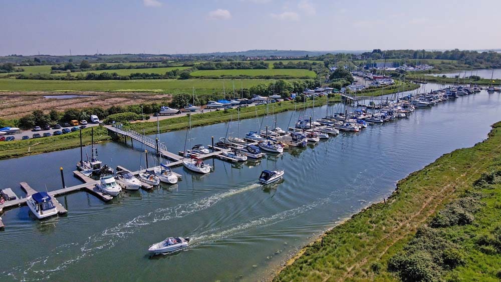
This article is part of a paid collaboration with Yacht Havens. A peaceful hamlet On the banks of the River Crouch in rural Essex lies the village…
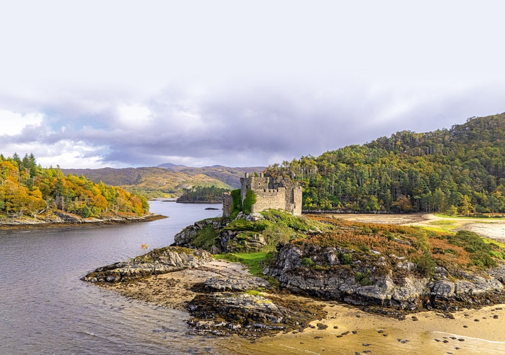
Ten years after his last visit, SIB enthusiast Peter Talbot returns to Loch Sunart, one of Scotland’s longest sea lochs.…
Join Phil & Jules Keen ribster Phil Dargavel and his wife Jules invite us to join them and their friends…