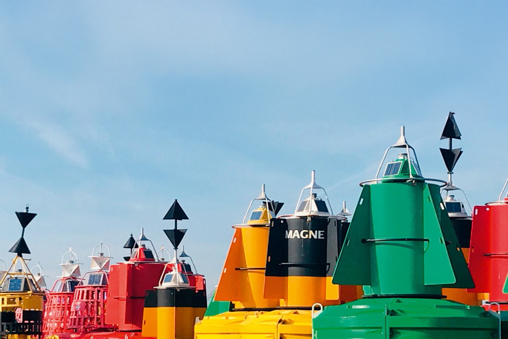
Understanding buoyage and pilotage when powerboating
In the fourth article in this ‘Back to Basics’ series, Paul Glatzel focuses on the key navigation elements of buoyage and pilotage …
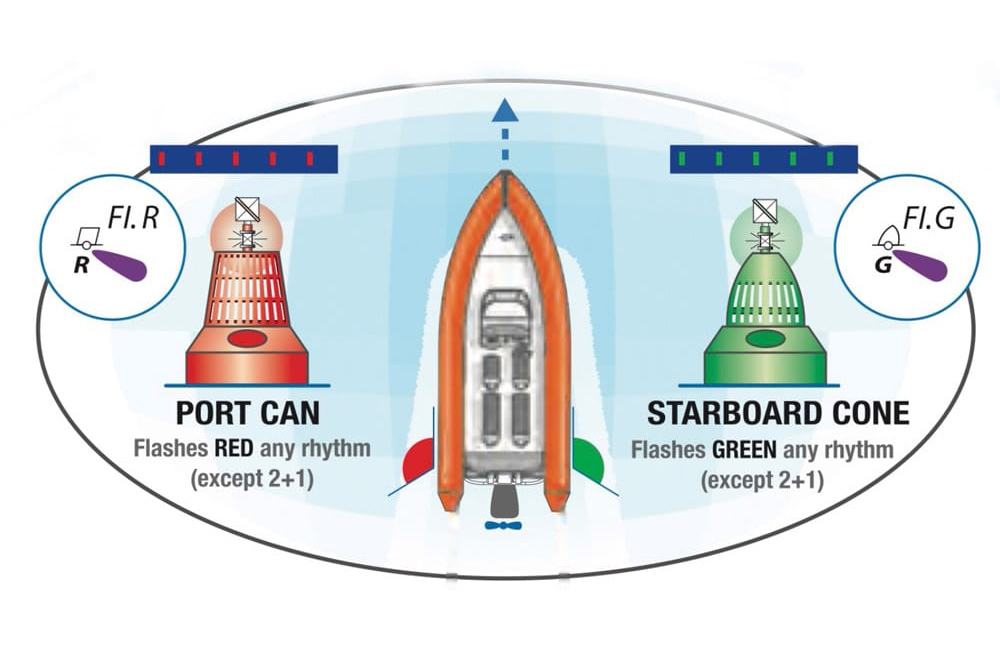
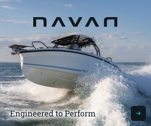
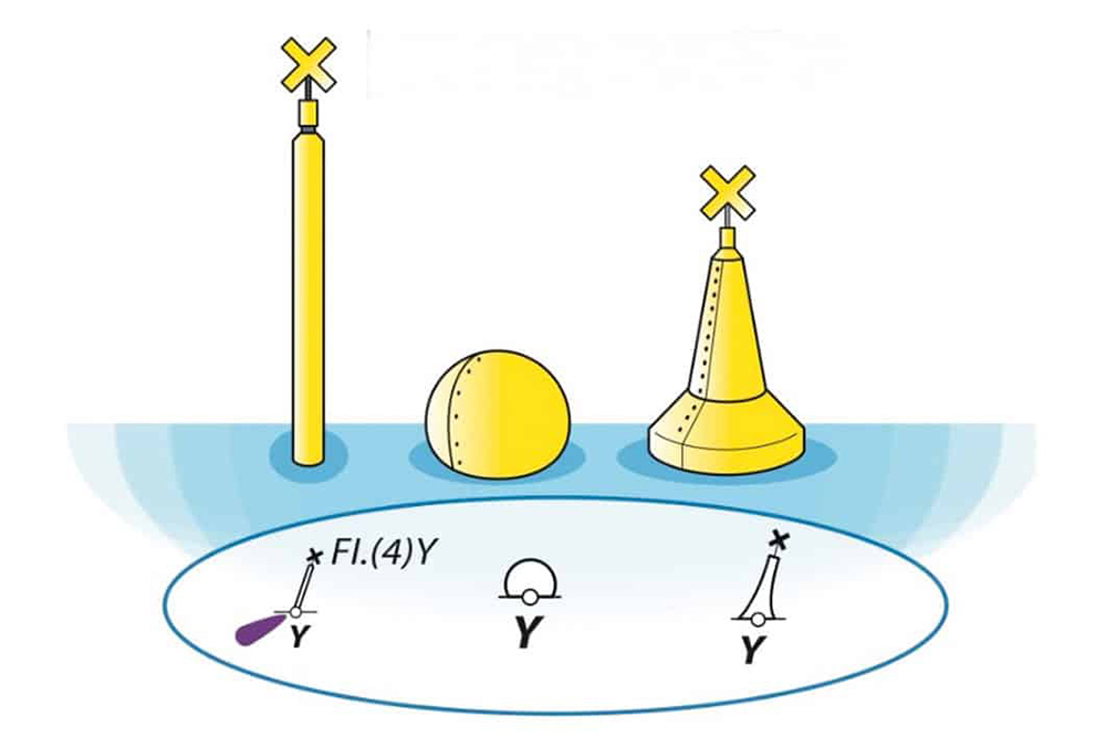
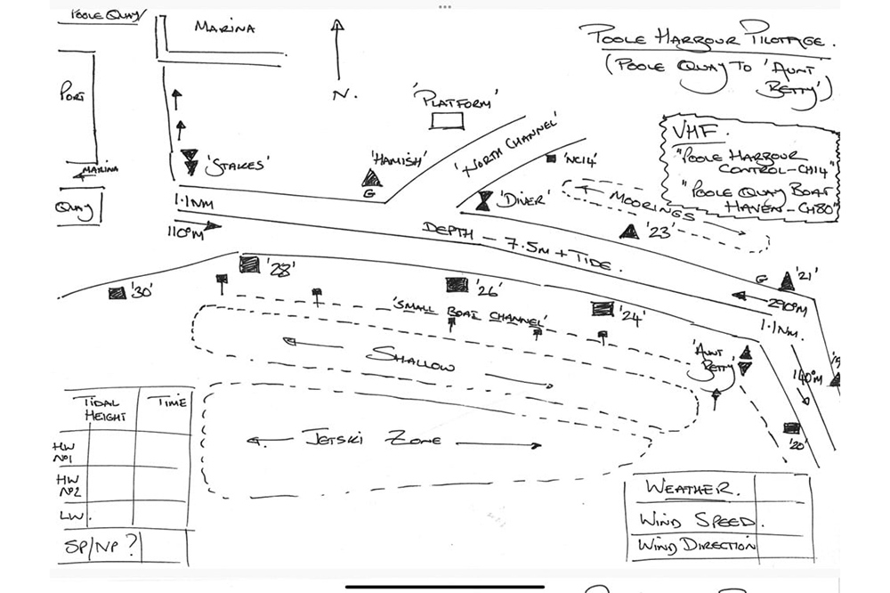
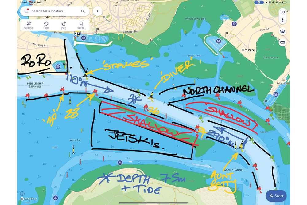
Previously, we’ve looked at the subjects of the COLREGs, charts and tides. The final elements of navigation to look at are the buoys we see when we’re afloat and how we then use our understanding of charts, tidal information and navigation features such as buoyage to make a safe passage.